Area Overview for Pentyrch Community
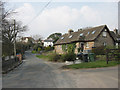
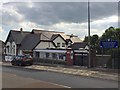
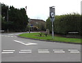
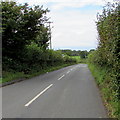
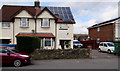
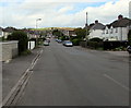
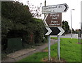
Photos of Pentyrch Community

Area Information
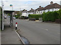
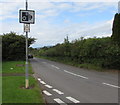
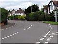
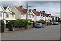
Living in Pentyrch Community offers a distinct pace set far from the city centre's rush. This civil parish sits on the western outskirts of Cardiff and covers an area of 18.4 km². The population stands at 1,417 residents, creating a relatively sparse residential landscape. You will find that daily life here often involves navigating zones that include the neighbouring villages of Creigiau and Gwaelod y Garth. The postcode CF15 identifies this specific locality within the wider region. Historical depth permeates the present-day environment, from ancient Stone-Age cromlechs to the medieval base-block of local landmarks. Residents can walk towards St Catwg's Church, which features origins dating back to the sixth century. The village hall, opened in 1976, remains an active community hub. You might frequent the King's Arms pub, a Grade II listed building that evolved from a 17th-century farm into a public house. While the core area holds a population of approximately 1,194, the wider parish census figures were higher in 2011. This mix of ancient history and small-scale living defines your experience. The area functions as a quiet residential pocket with clear ties to its agricultural and industrial past, including former ironworks and collieries that shaped the local economy centuries ago. The demographic profile of Pentyrch Community reveals a settled and mature community. The median age reaches 70 years, significantly higher than the national average for the United Kingdom. This age distribution suggests a population comprised largely of older residents. There is no data available to specify the most common age range beyond the total population figure, but the median age highlights a retirement-focused settlement. Home ownership levels are exceptionally high at 81%, indicating a predominantly owner-occupied area. This statistic contrasts sharply with many modern urban environments where rental markets dominate. The household composition and accommodation type data classify the totals without providing a detailed breakdown of single-person versus multi-generational homes. Ethnic group and religious affiliation data are noted as totals without specific percentages, reflecting the limited granularity in the current dataset. Planners and buyers should note that the area contains protected nature reserves and protected woodland, which account for a small percentage of the land but influence planning constraints. The area has passed assessments regarding flood risk and Ramsar wetland sites, showing low scores for those specific categories. The oldest部分组成 of the community likely draws on the rich history of sites like the Bronze Age burial mounds on the Garth. The housing market in Pentyrch Community is overwhelmingly characterised by owner-occupation, with 81% of homes held by their owners. This statistic paints a clear picture of a neighbourhood where stability is the norm rather than the exception. Buyers seeking to move into Pentyrch Community are entering a market where you are more likely to purchase a home than lease a property. The accommodation type data indicates a total classification rather than a specific split between detached houses, bungalows, or flats, but the high ownership rate supports the idea of traditional brick-and-mortar dwellings. The local property stock includes Victorian and Edwardian homes, often found near the historic King's Arms pub and St Catwg's Church. With a population of 1,417 spread across 18.4 km², density remains low, suggesting spacious plots compared to cities like Cardiff city centre. Families and retirees constitute the primary market for homes in Pentyrch Community. The low population density supports a quiet lifestyle, though you should expect higher travel times to main shopping districts. Schools near Pentyrch Community serve the local youth population, though specific capacity or performance data for the primary school is not detailed in the current records. Any buyer entering this market should be prepared for a more specialised purchase environment than found in high-density urban cores. Digital connectivity in Pentyrch Community varies significantly between fixed and mobile services. Mobile coverage scores an 85 out of a possible 100, indicating a very strong signal for residents using smartphones and tablets. You can expect reliable voice and data access for most mobile carriers across the parish boundaries. Fixed broadband, however, presents a different picture. The quality score sits at 50 out of 100, which describes as fair rather than fast. This score suggests that downloading large files or streaming high-definition video may occur at average speeds. For those working from home where stable high-speed internet is essential, this factor requires careful consideration before purchasing a home in Pentyrch Community. The area lies on the western outskirts of Cardiff, meaning physical transport connections likely rely heavily on road networks leading into the city. While mobile networks perform admirably, your professional or leisure habits that demand superior fixed-line speeds might be constrained. Residents relying on Zoom calls or large cloud backups must understand this limitation. The village hall and Pentyrch Rugby Football Club remain fully functional for community activities despite these technical constraints. If your daily routine requires constant, high-bandwidth internet access, you should verify current provider speeds with your chosen ISP before committing to buying property in this specific locality. Safety and environmental conditions in Pentyrch Community show a mixed but generally manageable picture. Flood risk coverage presents a low threat, with the assessment level passing and a low score of 3.94. This means you have minimal concern regarding property flooding from heavy rain or river levels rising. No Ramsar wetland sites or Areas of Outstanding Natural Beauty exist within the parish boundaries, so no major wetland planning constraints apply to new developments. However, the area contains protected nature reserves, which generate a warning level assessment with a score of 2.89. This constraint means that building or significantly altering land in or near these reserves faces stricter regulations. Protected woodland also exists within the parish, holding a warning level assessment score of 15.43. These areas add to the green character of the village but limit development potential. Crime risk data is currently unavailable for this location, as the specific statistical datasets are only accessible for areas in England; therefore, no official crime figures exist for this Welsh parish to guide your decision. The presence of ancient monuments, including a Stone-Age cromlech and Bronze Age burial mounds, does not impact daily safety but preserves historical integrity. Your environment is safe from flooding but subject to conservation rules in specific zones. What is the community feel like for new residents moving to Pentyrch Community?The area centres on a civil parish feel with a population of 1,417 spread over 18.4 km². You will encounter the village hall, opened in 1976, and local sports clubs like Pentyrch Rugby Football Club. The housing stock is 81% owner-occupied, suggesting a stable, established neighbourhood where long-term residents dominate. Historic landmarks such as St Catwg's Church and the King's Arms pub anchor daily life. The community includes neighbouring villages like Creigiau and Gwaelod y Garth, offering a connected but low-density living experience. Who primarily lives in this parish and what is the age profile?The median age in Pentyrch Community is 70 years, indicating a mature population. There is no specific breakdown of household types beyond total figures, but the age data clearly points to significant retirement presence. The area does not provide detailed statistics on ethnicity or religion breakdowns in the current data. With 81% home ownership, the area attracts buyers over renters, reinforcing the sense of a settled, long-term community where the average resident is significantly older than the national demographic average. How good is the transport and internet connectivity for daily use?Mobile coverage rates a high 85 out of 100, providing excellent signal quality for phones. Fixed broadband, however, scores 50 out of 100, describing as fair rather than excellent. This gap means high-speed internet for heavy downloading or streaming may be inconsistent compared to urban networks. Physical location on the western outskirts of Cardiff affects commute times into the city centre. While you can access nearby villages and historic sites easily, relying on fast fixed-line connections for work may require verifying specific provider speeds in your chosen street. What are the main safety concerns or planning constraints I should know about?Flood risk is low with a score of 3.94, meaning you are unlikely to face water-related property damage. However, the area contains protected nature reserves and protected woodland, both flagged with warning levels. These environmental protections restrict where you can build or extend your property. Crime statistics are not available for this Welsh area as the data is currently limited to England. You must navigate planning rules regarding these green spaces carefully. The absence of AONB or Ramsar sites reduces some planning barriers, but the retained natural features keep development regulations in play.
- Area Type
- Parish
- Area Size
- 18.4 km²
- Population
- 1417
- Population Density
- 77 people/km²
Demographics
The demographic profile of Pentyrch Community reveals a settled and mature community. The median age reaches 70 years, significantly higher than the national average for the United Kingdom. This age distribution suggests a population comprised largely of older residents. There is no data available to specify the most common age range beyond the total population figure, but the median age highlights a retirement-focused settlement. Home ownership levels are exceptionally high at 81%, indicating a predominantly owner-occupied area. This statistic contrasts sharply with many modern urban environments where rental markets dominate. The household composition and accommodation type data classify the totals without providing a detailed breakdown of single-person versus multi-generational homes. Ethnic group and religious affiliation data are noted as totals without specific percentages, reflecting the limited granularity in the current dataset. Planners and buyers should note that the area contains protected nature reserves and protected woodland, which account for a small percentage of the land but influence planning constraints. The area has passed assessments regarding flood risk and Ramsar wetland sites, showing low scores for those specific categories. The oldest部分组成 of the community likely draws on the rich history of sites like the Bronze Age burial mounds on the Garth. The housing market in Pentyrch Community is overwhelmingly characterised by owner-occupation, with 81% of homes held by their owners. This statistic paints a clear picture of a neighbourhood where stability is the norm rather than the exception. Buyers seeking to move into Pentyrch Community are entering a market where you are more likely to purchase a home than lease a property. The accommodation type data indicates a total classification rather than a specific split between detached houses, bungalows, or flats, but the high ownership rate supports the idea of traditional brick-and-mortar dwellings. The local property stock includes Victorian and Edwardian homes, often found near the historic King's Arms pub and St Catwg's Church. With a population of 1,417 spread across 18.4 km², density remains low, suggesting spacious plots compared to cities like Cardiff city centre. Families and retirees constitute the primary market for homes in Pentyrch Community. The low population density supports a quiet lifestyle, though you should expect higher travel times to main shopping districts. Schools near Pentyrch Community serve the local youth population, though specific capacity or performance data for the primary school is not detailed in the current records. Any buyer entering this market should be prepared for a more specialised purchase environment than found in high-density urban cores. Digital connectivity in Pentyrch Community varies significantly between fixed and mobile services. Mobile coverage scores an 85 out of a possible 100, indicating a very strong signal for residents using smartphones and tablets. You can expect reliable voice and data access for most mobile carriers across the parish boundaries. Fixed broadband, however, presents a different picture. The quality score sits at 50 out of 100, which describes as fair rather than fast. This score suggests that downloading large files or streaming high-definition video may occur at average speeds. For those working from home where stable high-speed internet is essential, this factor requires careful consideration before purchasing a home in Pentyrch Community. The area lies on the western outskirts of Cardiff, meaning physical transport connections likely rely heavily on road networks leading into the city. While mobile networks perform admirably, your professional or leisure habits that demand superior fixed-line speeds might be constrained. Residents relying on Zoom calls or large cloud backups must understand this limitation. The village hall and Pentyrch Rugby Football Club remain fully functional for community activities despite these technical constraints. If your daily routine requires constant, high-bandwidth internet access, you should verify current provider speeds with your chosen ISP before committing to buying property in this specific locality. Safety and environmental conditions in Pentyrch Community show a mixed but generally manageable picture. Flood risk coverage presents a low threat, with the assessment level passing and a low score of 3.94. This means you have minimal concern regarding property flooding from heavy rain or river levels rising. No Ramsar wetland sites or Areas of Outstanding Natural Beauty exist within the parish boundaries, so no major wetland planning constraints apply to new developments. However, the area contains protected nature reserves, which generate a warning level assessment with a score of 2.89. This constraint means that building or significantly altering land in or near these reserves faces stricter regulations. Protected woodland also exists within the parish, holding a warning level assessment score of 15.43. These areas add to the green character of the village but limit development potential. Crime risk data is currently unavailable for this location, as the specific statistical datasets are only accessible for areas in England; therefore, no official crime figures exist for this Welsh parish to guide your decision. The presence of ancient monuments, including a Stone-Age cromlech and Bronze Age burial mounds, does not impact daily safety but preserves historical integrity. Your environment is safe from flooding but subject to conservation rules in specific zones. What is the community feel like for new residents moving to Pentyrch Community?The area centres on a civil parish feel with a population of 1,417 spread over 18.4 km². You will encounter the village hall, opened in 1976, and local sports clubs like Pentyrch Rugby Football Club. The housing stock is 81% owner-occupied, suggesting a stable, established neighbourhood where long-term residents dominate. Historic landmarks such as St Catwg's Church and the King's Arms pub anchor daily life. The community includes neighbouring villages like Creigiau and Gwaelod y Garth, offering a connected but low-density living experience. Who primarily lives in this parish and what is the age profile?The median age in Pentyrch Community is 70 years, indicating a mature population. There is no specific breakdown of household types beyond total figures, but the age data clearly points to significant retirement presence. The area does not provide detailed statistics on ethnicity or religion breakdowns in the current data. With 81% home ownership, the area attracts buyers over renters, reinforcing the sense of a settled, long-term community where the average resident is significantly older than the national demographic average. How good is the transport and internet connectivity for daily use?Mobile coverage rates a high 85 out of 100, providing excellent signal quality for phones. Fixed broadband, however, scores 50 out of 100, describing as fair rather than excellent. This gap means high-speed internet for heavy downloading or streaming may be inconsistent compared to urban networks. Physical location on the western outskirts of Cardiff affects commute times into the city centre. While you can access nearby villages and historic sites easily, relying on fast fixed-line connections for work may require verifying specific provider speeds in your chosen street. What are the main safety concerns or planning constraints I should know about?Flood risk is low with a score of 3.94, meaning you are unlikely to face water-related property damage. However, the area contains protected nature reserves and protected woodland, both flagged with warning levels. These environmental protections restrict where you can build or extend your property. Crime statistics are not available for this Welsh area as the data is currently limited to England. You must navigate planning rules regarding these green spaces carefully. The absence of AONB or Ramsar sites reduces some planning barriers, but the retained natural features keep development regulations in play.
Household Size
Accommodation Type
Tenure
Ethnic Group
Religion
Household Composition
Age
Household Deprivation
NS-SEC
Explore more demographic insights in this area
Go to Demographics tabPlanning
Planning Constraints
- Flood RiskPremium
- Ramsar Wetland SitesPremium
- Area of Outstanding Natural BeautyPremium
- Protected Nature ReservePremium
- Protected WoodlandPremium
- Crime RiskPremium