Area Overview for Llanrumney Community
Photos of Llanrumney Community


Area Information
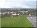
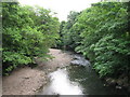
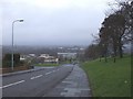
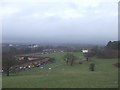
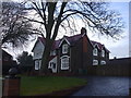
Living in Llanrumney Community offers a distinctly suburban experience within east Cardiff, defined by its transformation from rural aristocratic land into middle-class housing. This civil parish covers an area of 3.0 km² and forms an electoral ward within the city. The name reflects the local Rumney River, with the Welsh prefix *Llan* signifying church or parish. The modern estate emerged in the 1950s when Cardiff City Council compulsorily purchased Llanrumney Hall and its 700-acre parkland, replacing the previous Tredegar Hunt fox-hunting grounds with extensive streets of homes. Today, the area blends post-war council housing estates with some private properties, creating a space where original bungalows and new builds coexist. The landmark Llanrumney Hall and the Rumney Recreation Ground serve as central community spaces. Residents in Llanrumney Community enjoy access to the Eastern Leisure Centre, which has served the local population since 1982. The overall character remains residential, focusing on family life and community engagement rather than commercial activity.
- Area Type
- Parish
- Area Size
- 3.0 km²
- Population
- Not available
- Population Density
- Not available
Demographics
The community in Llanrumney Community reflects a settled population with a median age of 70 years. This high median suggests the area is dominated by older residents who have lived there for decades. Data confirms that the most common age group aligns with the total population count, indicating a wide spread rather than a tight cluster of young adults or families with young children. House ownership stands at 55%, meaning slightly more than half of the people in the parish own their homes outright. The remaining 45% reside in rented accommodation, which includes both council properties and social housing from the era of the 1950s estate build. Household composition data categorizes the total number of households without specifying single-person or multi-generational breakdowns. The area contains a total population of approximately 1,711 people across these 1,711 households. Ethnically, the parish records the total ethnic make-up of the residents without isolating specific minority groups. Religious affiliation is recorded as a total figure for the parish. These demographic trends paint a picture of a mature, established neighbourhood where life pace is generally slower than in student-oriented suburbs.
Household Size
Accommodation Type
Tenure
Ethnic Group
Religion
Household Composition
Age
Household Deprivation
NS-SEC
Explore more demographic insights in this area
Go to Demographics tabPlanning
Planning Constraints
- Flood RiskPremium
- Ramsar Wetland SitesPremium
- Area of Outstanding Natural BeautyPremium
- Protected Nature ReservePremium
- Protected WoodlandPremium
- Crime RiskPremium