Area Overview for Splott Community
Photos of Splott Community

Area Information
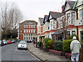
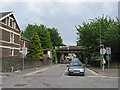
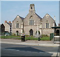
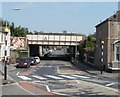
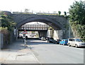
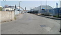
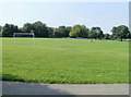
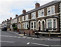
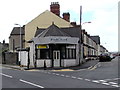
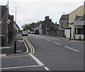
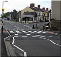
Splott Community is a civil parish situated in the south of Cardiff, located just east of the city centre. This district spans 1.9 km² and is characterised by densely packed Victorian terraced housing that reflects its industrial origins. The area was originally marshland between Roath Village and the sea, which was developed into an artisan suburb by architects Habershon & Fawckner during the 1880s and 1890s. Rapid urbanisation occurred when the East Moors Steelworks opened in 1891, attracting workers from Dowlais and accelerating residential growth. Today, the community is home to approximately 13,000 residents who live in a suburb defined by its rigid gridiron street pattern. You will experience daily life shaped by these historic boundaries, including the railway line that effectively separated the area from the north. Local highlights include the Magic Roundabout and its associated market, which remain central points of activity. Splott Park, which opened in 1901, continues to function as a key community facility. The area also retains connections to its working-class heritage through the Old Illtydians club and the site of the former St Illtyd's College. Living in Splott offers proximity to a rich history of steel production and religious infrastructure, with Welsh-language chapels established in the late 19th century to serve the immigrant workforce. The Great Eastern Hotel currently occupies the site of the original farmhouse, marking the transition from agricultural land to a bustling urban district.
- Area Type
- Parish
- Area Size
- 1.9 km²
- Population
- Not available
- Population Density
- Not available
Demographics
The demographic profile of Splott Community reflects a mature population. The median age within the parish is 70 years, indicating that a significant portion of residents are older adults. The provided data categorises the household composition for the total population, although specific breakdowns of single-person households versus families are not detailed in the available figures. Regarding ownership, 43% of residents in the civil parish own their homes outright or with a mortgage, while the remaining majority reside in rental accommodation. This statistic suggests a mixed market where securing ownership is achievable for nearly half the population. The area encompasses a total population of approximately 13,000 people, creating a tightly knit residential environment. While the data provides an overall median age, it does not specify the distribution within younger age brackets or the 70+ demographic. Consequently, you should expect a community where older residents are a significant presence, influencing local services and amenities. The accommodation data covers the total stock, revealing a diverse mix of residential units suitable for various household sizes. There is no specific data available regarding the predominant ethnic group or religious affiliations within the specific parish boundaries, but historical records note that notable Welsh-speaking communities remained significant following migration from Dowlais. Your experience of living here will likely involve interacting with a settled, older demographic within a compact 1.9 km² space.
Household Size
Accommodation Type
Tenure
Ethnic Group
Religion
Household Composition
Age
Household Deprivation
NS-SEC
Explore more demographic insights in this area
Go to Demographics tabPlanning
Planning Constraints
- Flood RiskPremium
- Ramsar Wetland SitesPremium
- Area of Outstanding Natural BeautyPremium
- Protected Nature ReservePremium
- Protected WoodlandPremium
- Crime RiskPremium