Area Overview for Rumney Community
Photos of Rumney Community


Area Information
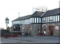
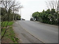
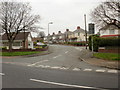
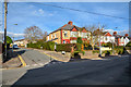
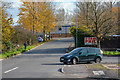
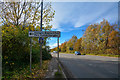
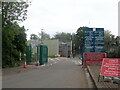
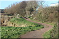
Rumney Community functions as a distinct residential parish in east Cardiff, Wales, offering a grounded suburban lifestyle. This civil parish covers an area of 4.2 km² and holds a population of 1416 residents. Historically part of Monmouthshire, the community lies east of the River Rhymney and was incorporated into Cardiff in 1938. The locality has deep historical roots, with evidence of habitation dating back to the Bronze Age and Roman roads passing nearby. Specific sites such as Caer Castell and the Church of St Augustine reflect this layered past. Daily life in Rumney revolves around the mix of social and private housing that defines the suburb. You will find local amenities including shops, cafés, and beauty salons concentrated along Newport Road and Rumney Hill. The area remains predominantly residential, balancing historical charm with modern conveniences. As a civil parish, Rumney offers a defined sense of place within the larger city. It retains its identity while providing access to wider Cardiff services. For those seeking a home in this established parish, the combination of history and residential focus creates a stable environment.
- Area Type
- Parish
- Area Size
- 4.2 km²
- Population
- 1416
- Population Density
- 340 people/km²
Demographics
The community profile of Rumney Community indicates a mature population structure. The median age stands at 70, marking this as a significantly older locality compared to the national average. This demographic skew suggests a neighbourhood where many residents are retired or approaching retirement. Home ownership is high, with 68% of households owning their property. This level reflects long-term settlement patterns rather than a transient rental market. The household composition and accommodation type data confirm that domestic residents form the core of this parish. Diversity data is not broken down by specific ethnic or religious groups in the available records. Consequently, the community presents as a relatively homogenous residential zone defined by age rather than cultural variance. The high concentration of older residents likely influences local services and community activities. You should expect a quieter pace of life suited to those in later life stages. The 68% ownership rate provides security for current owners and stability for the area. This demographic reality means services are tailored towards an older customer base. Understanding this age profile is essential for anyone considering homes in Rumney Community.
Household Size
Accommodation Type
Tenure
Ethnic Group
Religion
Household Composition
Age
Household Deprivation
NS-SEC
Explore more demographic insights in this area
Go to Demographics tabPlanning
Planning Constraints
- Flood RiskPremium
- Ramsar Wetland SitesPremium
- Area of Outstanding Natural BeautyPremium
- Protected Nature ReservePremium
- Protected WoodlandPremium
- Crime RiskPremium