Area Overview for Riverside Community
Photos of Riverside Community

Area Information
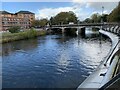
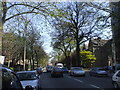
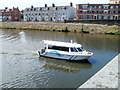
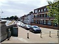
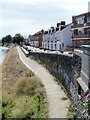
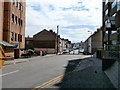
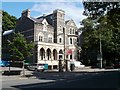
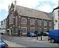
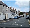
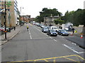
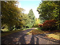
Riverside Community is a distinctive civil parish and inner-city district situated within Cardiff, Wales. You will find this area located to the west of the city centre, separated by the River Taff. The postcode CF11 5UF defines its modern boundaries, while the coordinates 51.481327, -3.198073 pinpoint its central location. Covering an area of 71.3 hectares,這裡 encompasses a population of around 1,540 residents. This compact footprint creates a tight-knit environment where daily life unfolds with a specific sense of place. Historical context adds depth to your understanding of the locale; the region once hosted the early grounds of Riverside A.F.C. before the club relocated to Ninian Park by 1910. Sophia Gardens now stands as a notable feature, marking the site of the club's first home ground. Living in Riverside Community means being part of a district with deep sporting heritage yet retaining its local character as an inner-city ward. TheCivil parish status suggests a level of administrative recognition separate from the wider urban sprawl. You can commute directly across the river to enjoy city amenities while residing in this specific, bounded district. The area combines urban convenience with a defined historical narrative rooted in the late nineteenth and early twentieth centuries.
- Area Type
- Parish
- Area Size
- 71.3 hectares
- Population
- Not available
- Population Density
- Not available
Demographics
The community profile reveals a mature demographic concentrated in Riverside Community. Residents range from toddlers to nonagenarians, with a median age of 70 years. This figure indicates a significant presence of older generations within the district. Household composition data confirms a total count of households across the 71.3 hectare area. Homeownership stands at 38 per cent, meaning the majority of households do not own their properties outright. This statistic indicates a predominantly rental market or an area where many residents rent from landlords or housing associations. Specific figures for the most common age range, predominant ethnic group, religion, and accommodation type are not separately broken down in the available reports. The total coverage for these categories suggests a diverse cross-section of the population exists here without a single dominant demographic pattern taking over. For a potential homebuyer, a 38 per cent ownership rate presents a clear indication of property affordability challenges or a stable rental sector. You should approach viewing homes here with the expectation of negotiating in a market where sellers lack leverage compared to owner-occupied domains elsewhere. The high median age often correlates with specific needs regarding proximity to services, although daily life continues for families and younger workers residing in the district.
Household Size
Accommodation Type
Tenure
Ethnic Group
Religion
Household Composition
Age
Household Deprivation
NS-SEC
Explore more demographic insights in this area
Go to Demographics tabPlanning
Planning Constraints
- Flood RiskPremium
- Ramsar Wetland SitesPremium
- Area of Outstanding Natural BeautyPremium
- Protected Nature ReservePremium
- Protected WoodlandPremium
- Crime RiskPremium