Area Overview for Rhiwbina Community
Photos of Rhiwbina Community
Area Information
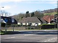
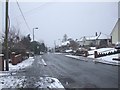
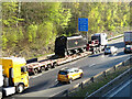
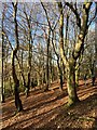
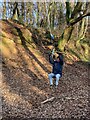
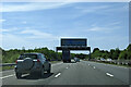
Rhiwbina Community sits as a distinct civil parish in the north of Cardiff, covering an area of 6.4 km². With a population of 1,521, this leaves a density of 237 people per square kilometre, creating a quiet residential atmosphere rather than a crowded urban environment. Originally a small hamlet, the area developed significantly after Lord Tredegar donated land in the 19th century. The layout you see today stems from a 1912 plan by Professor Stanley Jevons, establishing Rhiwbina Garden Village. This design features tree-lined avenues and spacious homes, which lends the suburb a park-like quality despite its proximity to the city. Living in Rhiwbina Community offers a stark contrast to the nearby urban sprawl. The core around the village crossroads retains a sleepy, peaceful feel, supported by a strong local identity. Whitchurch Hill borders the area to the north, rising above the main settlement. You will find that the location balances rural heritage with modern connectivity, anchored by Rhiwbina railway station which has served the area since 1911. The region retains a supportive stance toward Welsh language and culture, adding depth to the community fabric. While it feels secluded, it remains an accessible pocket within the Cardiff metropolitan area. The combination of historical roots, careful planning, and low density defines the experience for new residents considering this parish.
- Area Type
- Parish
- Area Size
- 6.4 km²
- Population
- 1521
- Population Density
- 237 people/km²
Demographics
The demographic profile of Rhiwbina Community reveals a settled, older population. The median age stands at 70 years, indicating a community dominated by retirees and older adults. This age structure suggests a slow pace of life where the daily rhythm often revolves around leisure and established routines rather than the hustle typical of younger neighbourhoods. Home ownership is exceptionally high, with 88% of residents owning their homes outright or with a mortgage. This level of equity transfer typically means the area is financially stable, with fewer long-term tenant turnovers affecting local continuity. Household composition reflects the age demographic, with most homes comprising single-person households or couples. You will not find the transient nature common in student zones or young professional enclaves. The population density of 237 people per square kilometre supports a low-strain environment where neighbours know one another. There are no signs of rapid demographic shifts within the provided data, reinforcing the idea of a static, traditional community. This stability appeals to those seeking a predictable environment. The high rate of home ownership also implies that previous generations have invested deeply in the locality, ensuring maintenance standards remain consistent. Consequently, the character of the area is defined by permanence rather than flux.
Household Size
Accommodation Type
Tenure
Ethnic Group
Religion
Household Composition
Age
Household Deprivation
NS-SEC
Explore more demographic insights in this area
Go to Demographics tabPlanning
Planning Constraints
- Flood RiskPremium
- Ramsar Wetland SitesPremium
- Area of Outstanding Natural BeautyPremium
- Protected Nature ReservePremium
- Protected WoodlandPremium
- Crime RiskPremium