Area Overview for Pentwyn Community
Photos of Pentwyn Community
Area Information
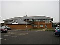
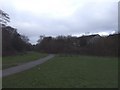
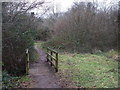
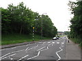
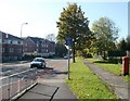
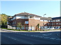
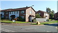
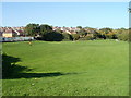
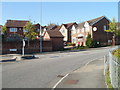
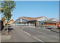
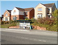
Pentwyn Community is a civil parish located in the east of Cardiff, covering an area of 1.8 km². It sits northeast of the city centre, bordered by Llanedeyrn to the south, Cyncoed to the west, and Pontprennau to the north. The River Rhymney forms its eastern border, defining the edge of this suburban district. The name stems from a former farm owned by the Kemys-Tynte family of Cefn Mably. Historically, the landscape was rural with farms surrounded by ancient woodland like Coed-y-Gores and Coed y Nant. Urbanisation only began in earnest after parts of Llanedeyrn came under Cardiff's jurisdiction in 1889 and the estate was broken up in 1921. Housing estates for post-war needs were constructed rapidly in the late 1960s, transforming the area from countryside to a residential neighbourhood. Today, living in Pentwyn Community means residing in a suburb developed during the late 1960s and 1970s with a mix of prefabricated and terraced houses, flats, and council properties. The area retains links to its agricultural roots through its name while functioning as a modern district with key features like the Maelfa Shopping Centre and Pentwyn Leisure Centre. You will find yourself in a location that balances historical significance with modern suburban convenience, situated near the M4 motorway just a few minutes away.
- Area Type
- Parish
- Area Size
- 1.8 km²
- Population
- Not available
- Population Density
- Not available
Demographics
The community in Pentwyn Community has a distinct age profile with a median age of 70. This indicates a population skewed heavily towards older residents. The most common age range data is currently categorised as "Age: Total," suggesting a demographic snapshot that focuses on the aggregate population rather than specific sub-groups in the provided records. Home ownership stands at 58%, meaning just over half of the households own their property outright. The remaining residents likely comprise private landlords or social housing tenants, reflecting the area's mixed tenure history. Household composition and accommodation type data are listed under a general "total" category, indicating that specific breakdowns of family sizes or single-person households are not specified in the available records. Predominant ethnic groups, religious affiliations, and detailed household composition breakdowns are also recorded as "total" without further subdivision. For someone considering homes in Pentwyn Community, the high median age suggests a quiet atmosphere where neighbours may be accustomed to a slower pace of life. This demographic reality often means lower turnover rates for properties and a community built around long-term residents rather than transient tenants. The 58% ownership figure provides stability, as owner-occupiers are less likely to move compared to private renters.
Household Size
Accommodation Type
Tenure
Ethnic Group
Religion
Household Composition
Age
Household Deprivation
NS-SEC
Explore more demographic insights in this area
Go to Demographics tabPlanning
Planning Constraints
- Flood RiskPremium
- Ramsar Wetland SitesPremium
- Area of Outstanding Natural BeautyPremium
- Protected Nature ReservePremium
- Protected WoodlandPremium
- Crime RiskPremium