Area Overview for Llanishen Community
Photos of Llanishen Community


Area Information
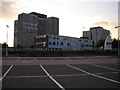
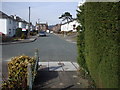
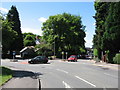
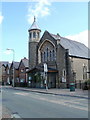
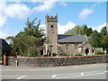
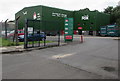
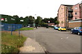
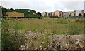
Llanishen Community is a civil parish situated north of Cardiff city centre, near the southern base of Caerphilly Mountain. This area covers 3.2 km² and holds a population of 1419 residents. You are stepping into a leafy suburban environment where residential estates like Crystal and Fishguard sit alongside parkland and industrial elements such as Parc Ty Glas. The neighbourhood retains its roots as a former village, now functioning as a dependent suburb of the capital. History defines the skyline, with views of tall tax office buildings and the transition from wooded farmland visible from afar. Life here balances quiet residential streets with the legacy of industry. The site of the former Royal Ordnance Factory now provides new housing, while residential estates offer a established character. You will find leafy roads winding through the parish, creating a setting that feels removed from immediate city congestion yet remains accessible. The area is defined by its specific blend of natural semi-rural features and modern residential development. St Isan's Church stands as a prominent landmark with Norman origins, overlooking Oval Park. This community offers a settled atmosphere for those seeking a home in a specific district of Cardiff without the density of the city core.
- Area Type
- Parish
- Area Size
- 3.2 km²
- Population
- 1419
- Population Density
- 438 people/km²
Demographics
The community within Llanishen Community displays a distinct age profile characterised by a median age of 70. This figure indicates that the majority of residents are retirees or seniors, shaping the daily rhythm and social fabric of the parish. The demographic data shows the most common age range recorded as Total Age, reflecting the dominance of older demographics across the board. With a population density of 438 people per km², you can expect a moderate spread of houses rather than high-rise apartments. Home ownership stands at 72%, meaning the vast majority of households own their properties outright or have a mortgage. This high rate of ownership suggests a stable community where long-term residents often plan to stay for years. The dwelling stock consists of various accommodation types typical of a Welsh parish, though specific breakdowns by structure are not detailed in the available records. Diversity figures such as predominant ethnicity and religion are categories within the data structure but do not provide specific percentages for this location. The community feels established, with a workforce historically tied to agriculture, water supply, and manufacturing, even as the current population skews towards retirement. This profile offers a quieter environment for those who prefer engaging with neighbours rather than managing transient tenants.
Household Size
Accommodation Type
Tenure
Ethnic Group
Religion
Household Composition
Age
Household Deprivation
NS-SEC
Explore more demographic insights in this area
Go to Demographics tabPlanning
Planning Constraints
- Flood RiskPremium
- Ramsar Wetland SitesPremium
- Area of Outstanding Natural BeautyPremium
- Protected Nature ReservePremium
- Protected WoodlandPremium
- Crime RiskPremium