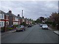
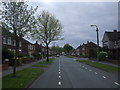
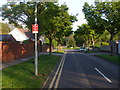
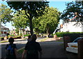
Area Overview for Heath Community
Photos of Heath Community

Area Information
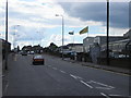
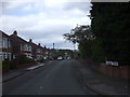
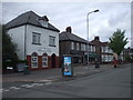
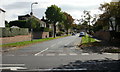
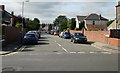
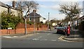
Living in Heath Community offers a distinct proximity to Cardiff's main hospital while maintaining the character of a civil parish. You reside in a compact area covering just 3.2 square kilometres, yet it houses over 3,000 people. This density creates a tight-knit environment centred around the coordinates 51.511853, -3.194695 within the CF14 3XW postcode area. The modern settlement evolved from the Great Heath, a landscape once known as common land, swamps and forest north of the city. Historian records show these common rights were extinguished by enclosure awards in 1802 and 1808, dividing the land among private owners including the Marquis of Bute. Urban development accelerated significantly after the Wyndham Lewis estate acquired 53 acres for the University Hospital Wales in 1971. Today, the local landscape blends green spaces with essential infrastructure. Heath Park, formerly a two-mile racecourse, now serves as a central recreational hub for residents. In 1938, Cardiff Council purchased Heath House and its surrounding parkland, transforming what was once derelict property into King George's Field. You will find that daily life here is shaped by this transformation from rural commons to suburban housing and key medical institutions. The community retains a sense of its agricultural past through remnants like Ton-yr-Ywen farm while functioning as a satellite of the city's major healthcare network.
- Area Type
- Parish
- Area Size
- 3.2 km²
- Population
- 3063
- Population Density
- 969 people/km²
Demographics
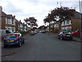
The community in Heath Community is defined by an established demographic profile suitable for retirees and long-term residents. The median age stands at 70 years, indicating that the population skews significantly older than the national average. You are likely to encounter neighbours who have remained in the area for decades, rather than families moving in temporarily. Census data shows that 81 per cent of residents own their homes, a statistic that underscores a deep sense of local attachment and stability. This high level of ownership suggests that the housing stock has been purchased rather than rented over time. The majority of households consist of older couples living in properties they have maintained or adapted to their needs. While specific breakdowns of ethnic groups, religious affiliations, and household compositions remain unspecified in current records, the overall picture points to a settled population. The absence of significant younger age brackets implies limited new housing developments catering to students or young families. Consequently, the local amenities and services cater primarily to the needs of an older population, from recurrent healthcare visits to leisure activities suited to mature interests. This stable demographic creates a quiet, predictable neighbourhood atmosphere where residents know each other well.
Household Size
Accommodation Type
Tenure
Ethnic Group
Religion
Household Composition
Age
Household Deprivation
NS-SEC
Explore more demographic insights in this area
Go to Demographics tabPlanning
Planning Constraints
- Flood RiskPremium
- Ramsar Wetland SitesPremium
- Area of Outstanding Natural BeautyPremium
- Protected Nature ReservePremium
- Protected WoodlandPremium
- Crime RiskPremium