Area Overview for Gabalfa Community
Photos of Gabalfa Community
Area Information
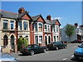
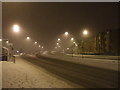
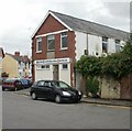
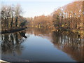
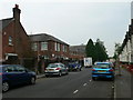
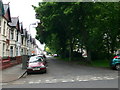
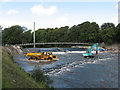
Residents living in Gabalfa Community find themselves in a compact district covering 1.3 km² on the north side of Cardiff. The area is defined by the Gabalfa Interchange, a major four-lane flyover where the A48, A470, and A469 converge. Historically known as Ceubalfa or the place of the boat, this location marked a ferry crossing point across the River Taff before the current infrastructure dominated the site. Today, the neighbourhood functions as an urban residential zone with a strong sense of community pride. Locals describe a settled atmosphere where neighbours know one another, despite acknowledging a need for local improvements such as a youth club. The district is bordered by Birchgrove and Heath to the north, Cathays and Maindy to the south, and Llandaff North to the northwest. This positioning places specific homes in Gabalfa Community within a ten-minute cycle of the city centre. The presence of Cycleway 1 along Allensbank Road and designated 20 mph zones adds to the daily usability of the area. Recent developments include traffic calming measures that adjust traffic flow for safety. The mix of council estate elements and private rentals creates a diverse living environment where everyone knows their surroundings.
- Area Type
- Parish
- Area Size
- 1.3 km²
- Population
- Not available
- Population Density
- Not available
Demographics
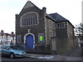
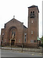
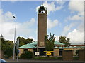
The demographic profile of Gabalfa Community shows a distinct age structure with a median age of 70. The data indicates the total age range constitutes the most common grouping within the population. Home ownership stands at 48% of households, while the remaining residents primarily occupy other tenure types. The area accommodates a significant number of students, with Cardiff University halls housing approximately 3,100 people alongside private rentals. This high concentration of younger residents contrasts with the older median age of the broader community. The district also contains council estate elements that house long-term families. Residents express pride in their neighbours and the collective strength of the community. Specific streets bear unique names, such as Australia Road and Newfoundland Road, reflecting the legacy of 'the Colonies' area surrounding St. Joseph's Church. These naming conventions add character to the housing stock. The population composition is structured around these educational institutions and traditional family homes. Living in Gabalfa Community means navigating an area where generational mixing is evident but the core community spirit remains intact.
Household Size
Accommodation Type
Tenure
Ethnic Group
Religion
Household Composition
Age
Household Deprivation
NS-SEC
Explore more demographic insights in this area
Go to Demographics tabPlanning
Planning Constraints
- Flood RiskPremium
- Ramsar Wetland SitesPremium
- Area of Outstanding Natural BeautyPremium
- Protected Nature ReservePremium
- Protected WoodlandPremium
- Crime RiskPremium