Area Overview for Cathays Community
Photos of Cathays Community

Area Information
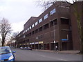
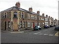
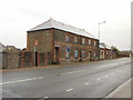
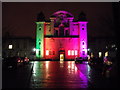
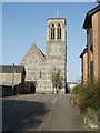
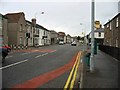
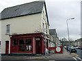
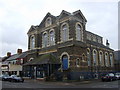
Cathays Community stands as a distinct civil parish within Cardiff, Wales, covering an area of 1.6 km² with a recorded population of 4,072 people. You will find this location north of the city centre, positioned firmly as an inner-city district that blends historic roots with modern civic energy. The area was almost entirely rural until 1875, when it transformed into a suburb built on former common land to house coal port labourers and merchants. Today, this history is visible in the densely packed terraced housing that still defines many streets. Despite the urban setting, the parish features Cathays Park, a major civic hub that anchors the neighbourhood with significant landmarks. You can walk past the City Hall, which opened between 1904 and 1905, and the University buildings established from 1903 onwards. The National Museum Cardiff, opened in 1922, also sits within this designated area. This concentration of cultural and political infrastructure means daily life revolves around key institutions like the Welsh National War Memorial and the Welsh Office. High population density reaches 2,502 people per square kilometre, reflecting the compact nature of these historic streets. When considering homes in Cathays Community, you are looking at a setting where residential spaces share boundaries with significant public buildings and green spaces. The area offers a tangible connection to Cardiff's industrial past while providing immediate access to centres of education and governance.
- Area Type
- Parish
- Area Size
- 1.6 km²
- Population
- 4072
- Population Density
- 2502 people/km²
Demographics
The age profile of Cathays Community shows a significantly older population compared to the national average. The median age is recorded at 70 years, indicating that the majority of reserves are senior citizens. This demographic reality shapes the community character, suggesting a neighbourhood where long-term residents tend to stay put rather than frequently move. You will encounter very few families with young children or working-age professionals in this specific parish. Home ownership levels are notably low, with only 22% of residents owning their property outright. Consequently, most households are likely comprised of renters who may move when their lease expires or their financial circumstances change. The data does not provide specific breakdowns for household composition, predominant ethnic groups, or religious affiliations, so precise figures for diversity are unavailable. However, the extreme age skew is a defining statistic for anyone researching living in Cathays Community. A median age of 70 suggests that amenities like healthcare services may see higher usage rates here. The low ownership rate of 22% also implies that house prices might be less volatile than in owner-occupied areas, though it limits equity building for current occupants. When you compare this to areas with younger demographics, Cathays offers a quieter, settled environment free from the noise of schools and young families. Your daily rhythm here would align more with early average shopping patterns and maturity of the neighbourhood fabric.
Household Size
Accommodation Type
Tenure
Ethnic Group
Religion
Household Composition
Age
Household Deprivation
NS-SEC
Explore more demographic insights in this area
Go to Demographics tabPlanning
Planning Constraints
- Flood RiskPremium
- Ramsar Wetland SitesPremium
- Area of Outstanding Natural BeautyPremium
- Protected Nature ReservePremium
- Protected WoodlandPremium
- Crime RiskPremium