Area Overview for Caerau Community
Photos of Caerau Community

Area Information
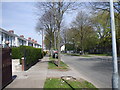
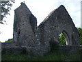
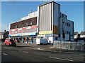
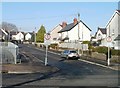
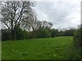
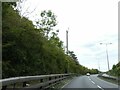
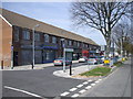
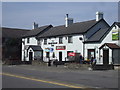
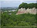
Caerau Community sits on the western fringe of Cardiff, spanning just 3.0 km² in South Wales. This small but historically rich area officially merged with the city in 1922, transforming from a rural settlement into a suburban housing estate. You find the community located south of Cowbridge Road West, at the base of a hill slope near coordinates 51.482797, -3.229795. The name derives from the Welsh word for forts, a nod to the Iron Age multivallate hillfort visible as earthworks today. While the broader Caerau and Ely wards contain around 26,000 residents, your specific neighbourhood holds approximately 1,394 people. Daily life here combines modern suburban living with layers of history, including Roman villa remains discovered in 1894 and the ruins of St Mary's Church. The land currently known as Trelai Park once hosted the Ely Racecourse before residential development took over. Although the area faces some social and economic challenges, the CAER Heritage Project has worked to revive local identity through a community heritage centre. You live close to cultural sites like Caerau Wood and pathways tracing the original hillfort network. This blend of prehistoric significance and post-war housing defines the character of homes in Caerau.
- Area Type
- Parish
- Area Size
- 3.0 km²
- Population
- Not available
- Population Density
- Not available
Demographics
The population profile in Caerau Community reflects an established neighbourhood with a significant number of older residents. The median age stands at 70 years, indicating that the area is predominantly inhabited by retirees or long-term residents rather than young families. Your specific age range data shows the total population holds this average, suggesting a quiet, settled community environment. Consequently, services and facilities likely cater to the needs of an older demographic. Home ownership levels in Caerau remain stable at 49%. This figure means roughly half of the residents own their homes outright or with a mortgage, while the other half rent their properties. This split creates a typical mix of owner-occupied and rented housing stock within the 3.0 km² boundary. Accommodation types and household composition data confirm a standard residential recipe without extreme concentrations of any single group. The area does not display specific data on predominant ethnic groups or religious affiliations, keeping the demographic picture general but focused on age and tenure. Living in Caerau means joining a community where the predominant daily rhythm is set by an older population, supporting a peaceful, low-strata lifestyle.
Household Size
Accommodation Type
Tenure
Ethnic Group
Religion
Household Composition
Age
Household Deprivation
NS-SEC
Explore more demographic insights in this area
Go to Demographics tabPlanning
Planning Constraints
- Flood RiskPremium
- Ramsar Wetland SitesPremium
- Area of Outstanding Natural BeautyPremium
- Protected Nature ReservePremium
- Protected WoodlandPremium
- Crime RiskPremium