Area Overview for Penyrheol, Trecenydd and Energlyn Community
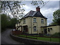
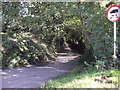
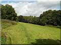
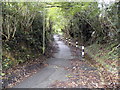
Photos of Penyrheol, Trecenydd and Energlyn Community
Area Information
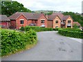
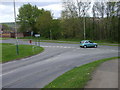
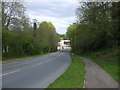
Penyrheol, Trecenydd and Energlyn Community is a civil parish located within Caerphilly county borough in South Wales. This distinct residential area covers an extent of 5.9 km² and serves a population of 3,912 residents. Positioned as part of the wider town of Caerphilly, the community encompasses the specific neighbourhoods of Penyrheol, Trecenydd, and Energlyn, creating a dense pocket of settlement at a density of 669 people per square kilometre. Historical roots here are deep, marked by the establishment of the Caerphilly Iron Furnace in 1680 and the construction of Groeswen as a meeting place in 1742. These features contribute to a setting that balances history with modern suburban life. Living in Penyrheol, Trecenydd and Energlyn Community means engaging with a space defined by its administrative status as a parish and its proximity to historical industrial landmarks. The postcode CF8 1XQ identifies the central core of this parish, acting as a geographic anchor for nearby locations such as Penyrheol at coordinates 51.58972°N 3.23917°W. Residents navigate a landscape where the legacy of the Morgan family's forges at Machen and Tredegar Park once influenced the local economy. Today, the community offers a specific slice of life characterised by a moderate population spread across identified residential areas, including the notable homes of The Crescent in Trecenydd. For those considering homes in Penyrheol, Trecenydd and Energlyn Community, understanding the scale of the parish is essential. The area functions as a cohesive unit within the county borough, blending the quiet of a civil parish with the accessibility of living near Caerphilly. The population figure of 3,912 suggests a community large enough to support local amenities while maintaining neighbourhood intimacy. Buyers exploring this parish should note its precise boundaries and coordinates, ensuring geographical clarity when viewing properties that form part of this established Welsh community.
- Area Type
- Parish
- Area Size
- 5.9 km²
- Population
- 3912
- Population Density
- 669 people/km²
Demographics
The demographic profile of Penyrheol, Trecenydd and Energlyn Community reveals a settlement with a distinctly mature character. You will find that the median age of residents stands at 70 years, indicating a population heavily weighted towards older age groups. While specific breakdowns for the most common age range are recorded as "Age: Total" in available records, the central tendency points clearly towards an elderled community. This age structure influences the daily rhythm of the parish, where services and social activities often cater to older households. Home ownership is the dominant housing tenure in this area, with 67% of residences owned by their occupants. This high rate of ownership suggests stability and long-term settlement, contrasting with rental-dominated markets found elsewhere. When viewing homes in Penyrheol, Trecenydd and Energlyn Community, you are more likely to encounter purpose-built dwellings or detached and semi-detached family homes rather than high-density rental blocks. The accommodation type data reflects a total composition suited to family units and retirees, which aligns with the older median age. Household composition figures are recorded generally under the total category, reinforcing the idea of standard family or single-occupancy dwellings typical of such demographics. There are no specific sub-categories breaking down household types like shared living or student arrangements within the current data. The predominant ethnic group and religious affiliations are similarly recorded as total figures, meaning detailed diversity statistics are not currently available for this parish. Despite the lack of granular diversity data, the high home ownership rate of nearly two-thirds indicates a resilient, settled community where residents invest in their local environment.
Household Size
Accommodation Type
Tenure
Ethnic Group
Religion
Household Composition
Age
Household Deprivation
NS-SEC
Explore more demographic insights in this area
Go to Demographics tabPlanning
Planning Constraints
- Flood RiskPremium
- Ramsar Wetland SitesPremium
- Area of Outstanding Natural BeautyPremium
- Protected Nature ReservePremium
- Protected WoodlandPremium
- Crime RiskPremium