Area Overview for NP22 5BY
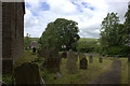
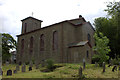
Photos of NP22 5BY
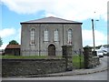
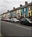
![Church Street, Rhymney [1] in NP22 5BY](https://images.propbar.co.uk/images/geograph/16/58/1658891_120.jpg)
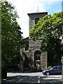
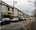
![Church Street, Rhymney [2] in NP22 5BY](https://images.propbar.co.uk/images/geograph/16/58/1658901_120.jpg)
100 photos from this area
Area Information
Key information about the NP22 5BY including its size, population, and administrative classification.
- Area Type
- Postcode
- Area Size
- 6976 m²
- Population
- 1233
- Population Density
- 1346 people/km²
House Prices in NP22 5BY
18
Properties
-
Average Sold Price
-
Lowest Price
-
Highest Price
Showing 18 properties
| Address | Type | Beds | Baths | Last Sale Price | Last Sale Date | |
|---|---|---|---|---|---|---|
| 60 Bryn Carno, Rhymney, NP22 5BY | Bungalow | - | - | - | - | |
| 80 Bryn Carno, Rhymney, NP22 5BY | Bungalow | - | - | - | - | |
| 58 Bryn Carno, Rhymney, NP22 5BY | Bungalow | - | - | - | - | |
| 70 Bryn Carno, Rhymney, NP22 5BY | Bungalow | - | - | - | - | |
| 1 Bryn Carno, Rhymney, NP22 5BY | house | - | - | - | - | |
| 64 Bryn Carno, Rhymney, NP22 5BY | Bungalow | - | - | - | - | |
| 82 Bryn Carno, Rhymney, NP22 5BY | Bungalow | - | - | - | - | |
| 84 Bryn Carno, Rhymney, NP22 5BY | Bungalow | - | - | - | - | |
| 74 Bryn Carno, Rhymney, NP22 5BY | Bungalow | - | - | - | - | |
| 7 Bryn Carno, Rhymney, NP22 5BY | house | - | - | - | - |
Page 1 of 2
Energy Efficiency in NP22 5BY
Amenities
Schools
| Rank | School | Type | Entry gender | Ages |
|---|
Explore more schools in this area
Go to Schools tabDemographics
Household Size
Two person
most common
Accommodation Type
Houses
most common
Tenure
38
majority
Ethnic Group
White
most common
Religion
N/A
most common
Household Composition
N/A
most common
Age
47
median
Adults (30-64 years)
most common
Household Deprivation
N/A
with no deprivation
NS-SEC
9
in Lower managerial occupations
Explore more demographic insights in this area
Go to Demographics tabPlanning
Planning Constraints
- Flood RiskPremium
- Ramsar Wetland SitesPremium
- Area of Outstanding Natural BeautyPremium
- Protected Nature ReservePremium
- Protected WoodlandPremium
- Crime RiskPremium