Area Overview for NP12 3QS
Photos of NP12 3QS

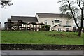
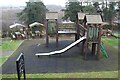
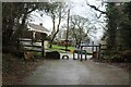
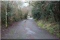
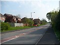
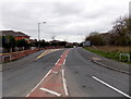
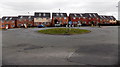
19 photos from this area
Area Information
Key information about the NP12 3QS including its size, population, and administrative classification.
- Area Type
- Postcode
- Area Size
- 1.2 hectares
- Population
- 1531
- Population Density
- 4588 people/km²
House Prices in NP12 3QS
36
Properties
£118,895
Average Sold Price
£42,000
Lowest Price
£190,000
Highest Price
Showing 36 properties
| Address | Type | Beds | Baths | Last Sale Price | Last Sale Date | |
|---|---|---|---|---|---|---|
| 6 Westgil Pen Ffordd, Blackwood, NP12 3QS | Semi-detached | 3 | 1 | £190,000 | Apr 2023 | |
| 22 Westgil Pen Ffordd, Blackwood, NP12 3QS | house | - | - | £169,950 | May 2021 | |
| 16 Westgil Pen Ffordd, Blackwood, NP12 3QS | house | - | - | £168,000 | Mar 2021 | |
| 4 Westgil Pen Ffordd, Blackwood, NP12 3QS | house | - | - | £140,000 | Nov 2020 | |
| 5 Westgil Pen Ffordd, Blackwood, NP12 3QS | Semi-detached | 3 | - | £149,950 | Jan 2019 | |
| 10 Westgil Pen Ffordd, Blackwood, NP12 3QS | Semi-detached | 3 | - | £125,000 | Oct 2017 | |
| 30 Westgil Pen Ffordd, Blackwood, NP12 3QS | Semi-detached | 3 | - | £82,500 | Mar 2015 | |
| 1 Westgil Pen Ffordd, Blackwood, NP12 3QS | Semi-detached | 3 | - | £156,500 | Feb 2015 | |
| 33 Westgil Pen Ffordd, Blackwood, NP12 3QS | Semi-detached | 3 | 1 | £140,000 | Feb 2014 | |
| 20 Westgil Pen Ffordd, Blackwood, NP12 3QS | Semi-detached | 4 | 1 | £150,000 | Mar 2008 |
Page 1 of 4
Energy Efficiency in NP12 3QS
Amenities
Schools
| Rank | School | Type | Entry gender | Ages |
|---|
Explore more schools in this area
Go to Schools tabDemographics
Household Size
Two person
most common
Accommodation Type
Houses
most common
Tenure
62
majority
Ethnic Group
White
most common
Religion
N/A
most common
Household Composition
N/A
most common
Age
47
median
Adults (30-64 years)
most common
Household Deprivation
N/A
with no deprivation
NS-SEC
24
in Lower managerial occupations
Explore more demographic insights in this area
Go to Demographics tabPlanning
Planning Constraints
- Flood RiskPremium
- Ramsar Wetland SitesPremium
- Area of Outstanding Natural BeautyPremium
- Protected Nature ReservePremium
- Protected WoodlandPremium
- Crime RiskPremium