Area Overview for NP12 3NG
Photos of NP12 3NG
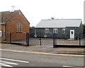
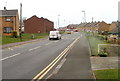
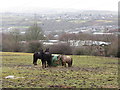
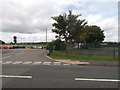
74 photos from this area
Area Information
Key information about the NP12 3NG including its size, population, and administrative classification.
- Area Type
- Postcode
- Area Size
- 2.8 hectares
- Population
- 1823
- Population Density
- 1619 people/km²
House Prices in NP12 3NG
40
Properties
£103,579
Average Sold Price
£37,500
Lowest Price
£192,500
Highest Price
Showing 40 properties
| Address | Type | Beds | Baths | Last Sale Price | Last Sale Date | |
|---|---|---|---|---|---|---|
| 69 Dylan Avenue, Cefn Fforest, NP12 3NG | house | 3 | 1 | £192,500 | Nov 2024 | |
| 44 Dylan Avenue, Cefn Fforest, NP12 3NG | Terraced | 3 | 1 | £145,000 | Aug 2023 | |
| 58 Dylan Avenue, Cefn Fforest, NP12 3NG | Semi-detached | 3 | 1 | £160,000 | Dec 2022 | |
| 50 Dylan Avenue, Cefn Fforest, NP12 3NG | house | - | - | £93,000 | Feb 2021 | |
| 66 Dylan Avenue, Cefn Fforest, NP12 3NG | Semi-detached | 3 | 1 | £125,000 | Nov 2018 | |
| 62 Dylan Avenue, Cefn Fforest, NP12 3NG | house | - | - | £115,000 | Dec 2017 | |
| 72 Dylan Avenue, Cefn Fforest, NP12 3NG | Semi-detached | - | - | £110,000 | Mar 2012 | |
| 70 Dylan Avenue, Cefn Fforest, NP12 3NG | Semi-detached | - | - | £95,000 | Nov 2010 | |
| 36 Dylan Avenue, Cefn Fforest, NP12 3NG | Semi-detached | - | - | £85,452 | May 2006 | |
| 57 Dylan Avenue, Cefn Fforest, NP12 3NG | Semi-detached | - | - | £45,500 | Feb 2003 |
Page 1 of 4
Energy Efficiency in NP12 3NG
Amenities
Schools
| Rank | School | Type | Entry gender | Ages |
|---|
Explore more schools in this area
Go to Schools tabDemographics
Household Size
Family (3-5 people)
most common
Accommodation Type
Houses
most common
Tenure
59
majority
Ethnic Group
White
most common
Religion
N/A
most common
Household Composition
N/A
most common
Age
47
median
Adults (30-64 years)
most common
Household Deprivation
N/A
with no deprivation
NS-SEC
25
in Lower managerial occupations
Explore more demographic insights in this area
Go to Demographics tabPlanning
Planning Constraints
- Flood RiskPremium
- Ramsar Wetland SitesPremium
- Area of Outstanding Natural BeautyPremium
- Protected Nature ReservePremium
- Protected WoodlandPremium
- Crime RiskPremium