Area Overview for NP12 1WR
Photos of NP12 1WR
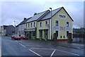
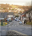
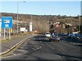
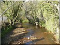
100 photos from this area
Area Information
Key information about the NP12 1WR including its size, population, and administrative classification.
- Area Type
- Postcode
- Area Size
- 1.3 hectares
- Population
- 1717
- Population Density
- 4471 people/km²
House Prices in NP12 1WR
24
Properties
£183,090
Average Sold Price
£18,000
Lowest Price
£440,000
Highest Price
Showing 24 properties
| Address | Type | Beds | Baths | Last Sale Price | Last Sale Date | |
|---|---|---|---|---|---|---|
| 24 Ashgrove, Blackwood, NP12 1WR | Detached | 4 | 2 | £440,000 | Apr 2021 | |
| 22 Ashgrove, Blackwood, NP12 1WR | house | - | - | £210,000 | Dec 2018 | |
| 8 Ashgrove, Blackwood, NP12 1WR | Detached | 4 | - | £238,000 | Feb 2017 | |
| 6 Ashgrove, Blackwood, NP12 1WR | house | - | - | £150,000 | Oct 2015 | |
| 10 Ashgrove, Blackwood, NP12 1WR | Detached | - | - | £305,000 | May 2008 | |
| 2 Ashgrove, Blackwood, NP12 1WR | house | - | - | £210,000 | Aug 2007 | |
| 18 Ashgrove, Blackwood, NP12 1WR | Detached | - | - | £109,950 | Feb 2003 | |
| 12 Ashgrove, Blackwood, NP12 1WR | house | - | - | £18,000 | Sep 1997 | |
| 17 Ashgrove, Blackwood, NP12 1WR | Detached | - | - | £66,950 | Jul 1995 | |
| 15 Ashgrove, Blackwood, NP12 1WR | Detached | - | - | £83,000 | Feb 1995 |
Page 1 of 3
Energy Efficiency in NP12 1WR
Amenities
Schools
| Rank | School | Type | Entry gender | Ages |
|---|
Explore more schools in this area
Go to Schools tabDemographics
Household Size
Family (3-5 people)
most common
Accommodation Type
Houses
most common
Tenure
84
majority
Ethnic Group
White
most common
Religion
N/A
most common
Household Composition
N/A
most common
Age
47
median
Adults (30-64 years)
most common
Household Deprivation
N/A
with no deprivation
NS-SEC
40
in Lower managerial occupations
Explore more demographic insights in this area
Go to Demographics tabPlanning
Planning Constraints
- Flood RiskPremium
- Ramsar Wetland SitesPremium
- Area of Outstanding Natural BeautyPremium
- Protected Nature ReservePremium
- Protected WoodlandPremium
- Crime RiskPremium