Area Overview for NP12 1DY
Photos of NP12 1DY
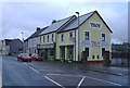
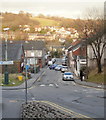
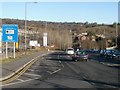
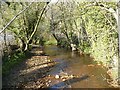
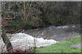
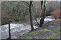
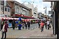
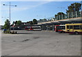
100 photos from this area
Area Information
Key information about the NP12 1DY including its size, population, and administrative classification.
- Area Type
- Postcode
- Area Size
- 1.1 hectares
- Population
- 1736
- Population Density
- 2740 people/km²
House Prices in NP12 1DY
27
Properties
£97,333
Average Sold Price
£20,000
Lowest Price
£171,500
Highest Price
Showing 27 properties
| Address | Type | Beds | Baths | Last Sale Price | Last Sale Date | |
|---|---|---|---|---|---|---|
| 42 Albany Road, Blackwood, NP12 1DY | Semi-detached | 2 | 1 | £125,000 | Feb 2025 | |
| 84 Albany Road, Blackwood, NP12 1DY | Semi-detached | 2 | - | £150,000 | Dec 2024 | |
| 56 Albany Road, Blackwood, NP12 1DY | Semi-detached | 2 | 1 | £140,000 | Jan 2023 | |
| 66 Albany Road, Blackwood, NP12 1DY | house | - | - | £127,000 | Oct 2020 | |
| 88 Albany Road, Blackwood, NP12 1DY | Semi-detached | 3 | 2 | £171,500 | Aug 2019 | |
| 74 Albany Road, Blackwood, NP12 1DY | house | 2 | 1 | £95,000 | Aug 2018 | |
| 68 Albany Road, Blackwood, NP12 1DY | house | - | - | £130,000 | Jul 2018 | |
| 46 Albany Road, Blackwood, NP12 1DY | Semi-detached | 2 | 1 | £94,000 | Jul 2018 | |
| 70 Albany Road, Blackwood, NP12 1DY | house | - | - | £83,500 | Sep 2014 | |
| 52 Albany Road, Blackwood, NP12 1DY | house | - | - | £90,000 | Oct 2013 |
Page 1 of 3
Energy Efficiency in NP12 1DY
Amenities
Schools
| Rank | School | Type | Entry gender | Ages |
|---|
Explore more schools in this area
Go to Schools tabDemographics
Household Size
Two person
most common
Accommodation Type
Houses
most common
Tenure
73
majority
Ethnic Group
White
most common
Religion
N/A
most common
Household Composition
N/A
most common
Age
47
median
Adults (30-64 years)
most common
Household Deprivation
N/A
with no deprivation
NS-SEC
27
in Lower managerial occupations
Explore more demographic insights in this area
Go to Demographics tabPlanning
Planning Constraints
- Flood RiskPremium
- Ramsar Wetland SitesPremium
- Area of Outstanding Natural BeautyPremium
- Protected Nature ReservePremium
- Protected WoodlandPremium
- Crime RiskPremium