Area Overview for NP12 0JR
Photos of NP12 0JR
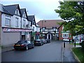
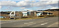
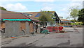
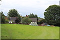
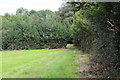
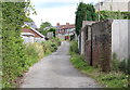
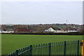
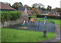
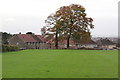
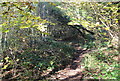
100 photos from this area
Area Information
Key information about the NP12 0JR including its size, population, and administrative classification.
- Area Type
- Postcode
- Area Size
- 1.5 hectares
- Population
- 1617
- Population Density
- 3548 people/km²
House Prices in NP12 0JR
49
Properties
£89,948
Average Sold Price
£21,500
Lowest Price
£156,000
Highest Price
Showing 49 properties
| Address | Type | Beds | Baths | Last Sale Price | Last Sale Date | |
|---|---|---|---|---|---|---|
| 48 Ashville, Oakdale, NP12 0JR | Terraced | 3 | 1 | £156,000 | Oct 2024 | |
| 14 Ashville, Oakdale, NP12 0JR | Terraced | 2 | 1 | £150,000 | Feb 2023 | |
| 25 Ashville, Oakdale, Blackwood, NP12 0JR | Terraced | 2 | - | £139,000 | Aug 2022 | |
| 20 Ashville, Oakdale, NP12 0JR | house | - | - | £130,000 | Mar 2021 | |
| 43 Ashville, Oakdale, NP12 0JR | house | - | - | £106,000 | Sep 2019 | |
| 33 Ashville, Oakdale, NP12 0JR | Terraced | 3 | 1 | £97,500 | Aug 2019 | |
| 21 Ashville, Oakdale, NP12 0JR | house | 3 | 1 | £83,000 | Mar 2019 | |
| 8 Ashville, Oakdale, NP12 0JR | house | - | - | £76,000 | Jul 2016 | |
| 40 Ashville, Oakdale, NP12 0JR | Terraced | 3 | 2 | £115,000 | Sep 2015 | |
| 16 Ashville, Oakdale, NP12 0JR | Terraced | 2 | 1 | £80,000 | Jun 2015 |
Page 1 of 5
Energy Efficiency in NP12 0JR
Amenities
Schools
| Rank | School | Type | Entry gender | Ages |
|---|
Explore more schools in this area
Go to Schools tabDemographics
Household Size
Two person
most common
Accommodation Type
Houses
most common
Tenure
68
majority
Ethnic Group
White
most common
Religion
N/A
most common
Household Composition
N/A
most common
Age
47
median
Adults (30-64 years)
most common
Household Deprivation
N/A
with no deprivation
NS-SEC
22
in Lower managerial occupations
Explore more demographic insights in this area
Go to Demographics tabPlanning
Planning Constraints
- Flood RiskPremium
- Ramsar Wetland SitesPremium
- Area of Outstanding Natural BeautyPremium
- Protected Nature ReservePremium
- Protected WoodlandPremium
- Crime RiskPremium