Area Overview for NP12 0GY
Photos of NP12 0GY
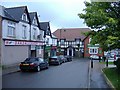

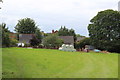
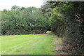
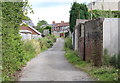
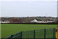
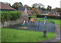
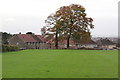
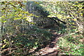
100 photos from this area
Area Information
Key information about the NP12 0GY including its size, population, and administrative classification.
- Area Type
- Postcode
- Area Size
- 1.1 hectares
- Population
- 2107
- Population Density
- 1037 people/km²
House Prices in NP12 0GY
19
Properties
£117,026
Average Sold Price
£49,950
Lowest Price
£207,000
Highest Price
Showing 19 properties
| Address | Type | Beds | Baths | Last Sale Price | Last Sale Date | |
|---|---|---|---|---|---|---|
| 11 Nant Gau, Oakdale, NP12 0GY | Semi-detached | 3 | - | £207,000 | Aug 2025 | |
| 5 Nant Gau, Oakdale, NP12 0GY | house | - | - | £186,500 | Sep 2022 | |
| 9 Nant-gau, Oakdale, Blackwood, NP12 0GY | Semi-detached | 3 | 2 | £142,500 | Sep 2019 | |
| 14 Nant Gau, Oakdale, NP12 0GY | Terraced | 2 | 1 | £125,000 | Jun 2018 | |
| 8 Nant Gau, Oakdale, NP12 0GY | house | 3 | - | £120,000 | May 2016 | |
| 4 Nant Gau, Oakdale, NP12 0GY | house | - | - | £117,000 | Jul 2015 | |
| 13 Nant Gau, Oakdale, NP12 0GY | house | - | - | £110,750 | May 2014 | |
| 3 Nant Gau, Oakdale, NP12 0GY | Detached | 3 | - | £173,000 | Feb 2014 | |
| 2 Nant Gau, Oakdale, NP12 0GY | Detached | 3 | 2 | £161,000 | Sep 2012 | |
| 7 Nant Gau, Oakdale, NP12 0GY | Terraced | - | - | £119,000 | Jul 2007 |
Page 1 of 2
Energy Efficiency in NP12 0GY
Amenities
Schools
| Rank | School | Type | Entry gender | Ages |
|---|
Explore more schools in this area
Go to Schools tabDemographics
Household Size
Family (3-5 people)
most common
Accommodation Type
Houses
most common
Tenure
85
majority
Ethnic Group
White
most common
Religion
N/A
most common
Household Composition
N/A
most common
Age
47
median
Adults (30-64 years)
most common
Household Deprivation
N/A
with no deprivation
NS-SEC
39
in Lower managerial occupations
Explore more demographic insights in this area
Go to Demographics tabPlanning
Planning Constraints
- Flood RiskPremium
- Ramsar Wetland SitesPremium
- Area of Outstanding Natural BeautyPremium
- Protected Nature ReservePremium
- Protected WoodlandPremium
- Crime RiskPremium