Area Overview for NP11 7HY
Photos of NP11 7HY
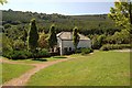

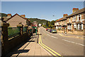
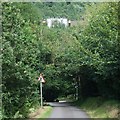


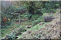

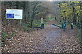
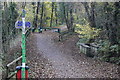
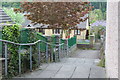
93 photos from this area
Area Information
Key information about the NP11 7HY including its size, population, and administrative classification.
- Area Type
- Postcode
- Area Size
- 7653 m²
- Population
- 1586
- Population Density
- 203 people/km²
House Prices in NP11 7HY
37
Properties
£68,255
Average Sold Price
£20,000
Lowest Price
£141,500
Highest Price
Showing 37 properties
| Address | Type | Beds | Baths | Last Sale Price | Last Sale Date | |
|---|---|---|---|---|---|---|
| 61 Islwyn Street, Cwmfelinfach, NP11 7HY | Terraced | 2 | 1 | £123,000 | Mar 2025 | |
| 49 Islwyn Street, Cwmfelinfach, NP11 7HY | house | - | - | £130,000 | Jun 2022 | |
| 25 Islwyn Street, Cwmfelinfach, NP11 7HY | house | - | - | £121,950 | Oct 2021 | |
| Llwyn-yr-eos, Islwyn Street, Cwmfelinfach, NP11 7HY | Detached | 3 | 1 | £141,500 | Jul 2021 | |
| 29 Islwyn Street, Cwmfelinfach, NP11 7HY | Terraced | 3 | - | £95,000 | Dec 2019 | |
| 41 Islwyn Street, Cwmfelinfach, NP11 7HY | house | - | - | £135,000 | Aug 2019 | |
| 45 Islwyn Street, Cwmfelinfach, NP11 7HY | house | - | - | £90,000 | Jun 2016 | |
| 59 Islwyn Street, Cwmfelinfach, NP11 7HY | house | - | - | £51,500 | Aug 2015 | |
| 1 Islwyn Street, Cwmfelinfach, NP11 7HY | Terraced | - | - | £97,500 | Apr 2011 | |
| 47 Islwyn Street, Cwmfelinfach, NP11 7HY | house | 3 | 1 | £54,950 | Jun 2004 |
Page 1 of 4
Energy Efficiency in NP11 7HY
Amenities
Schools
| Rank | School | Type | Entry gender | Ages |
|---|
Explore more schools in this area
Go to Schools tabDemographics
Household Size
Two person
most common
Accommodation Type
Houses
most common
Tenure
79
majority
Ethnic Group
White
most common
Religion
N/A
most common
Household Composition
N/A
most common
Age
47
median
Adults (30-64 years)
most common
Household Deprivation
N/A
with no deprivation
NS-SEC
28
in Lower managerial occupations
Explore more demographic insights in this area
Go to Demographics tabPlanning
Planning Constraints
- Flood RiskPremium
- Ramsar Wetland SitesPremium
- Area of Outstanding Natural BeautyPremium
- Protected Nature ReservePremium
- Protected WoodlandPremium
- Crime RiskPremium