Area Overview for NP11 7GF
Photos of NP11 7GF
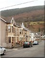
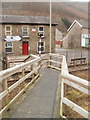
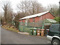
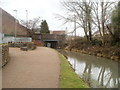
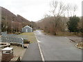
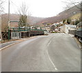
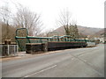
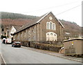
100 photos from this area
Area Information
Key information about the NP11 7GF including its size, population, and administrative classification.
- Area Type
- Postcode
- Area Size
- 2506 m²
- Population
- 1665
- Population Density
- 808 people/km²
House Prices in NP11 7GF
9
Properties
£128,740
Average Sold Price
£47,230
Lowest Price
£191,000
Highest Price
Showing 9 properties
| Address | Type | Beds | Baths | Last Sale Price | Last Sale Date | |
|---|---|---|---|---|---|---|
| 5, Gelli-unig Terrace, Gelli Unig Road, Pontywaun, NP11 7GF | Terraced | 2 | 2 | £188,000 | May 2024 | |
| 4, Gelli-unig Terrace, Gelli Unig Road, Pontywaun, NP11 7GF | Terraced | 3 | 1 | £191,000 | Dec 2023 | |
| 3, Gelli-unig Terrace, Gelli Unig Road, Pontywaun, NP11 7GF | Terraced | 3 | - | £139,950 | Jul 2019 | |
| 7, Gelli-unig Terrace, Gelli Unig Road, Pontywaun, NP11 7GF | Terraced | 3 | 1 | £140,000 | Dec 2017 | |
| 8, Gelli-unig Terrace, Gelli Unig Road, Pontywaun, NP11 7GF | Terraced | - | - | £120,000 | Sep 2005 | |
| 2, Gelli-unig Terrace, Gelli Unig Road, Pontywaun, NP11 7GF | Terraced | - | - | £75,000 | Sep 2003 | |
| 1, Gelli-unig Terrace, Gelli Unig Road, Pontywaun, NP11 7GF | Terraced | - | - | £47,230 | Jul 1999 | |
| 6, Gelli-unig Terrace, Gelli Unig Road, Pontywaun, NP11 7GF | Terraced | - | - | - | - | |
| Stables, Gelli Unig Road East Ul, Pontywaun, NP11 7GF | Equestrian | - | - | - | - |
Energy Efficiency in NP11 7GF
Amenities
Schools
| Rank | School | Type | Entry gender | Ages |
|---|
Explore more schools in this area
Go to Schools tabDemographics
Household Size
Two person
most common
Accommodation Type
Houses
most common
Tenure
79
majority
Ethnic Group
White
most common
Religion
N/A
most common
Household Composition
N/A
most common
Age
47
median
Adults (30-64 years)
most common
Household Deprivation
N/A
with no deprivation
NS-SEC
28
in Lower managerial occupations
Explore more demographic insights in this area
Go to Demographics tabPlanning
Planning Constraints
- Flood RiskPremium
- Ramsar Wetland SitesPremium
- Area of Outstanding Natural BeautyPremium
- Protected Nature ReservePremium
- Protected WoodlandPremium
- Crime RiskPremium