Area Overview for NP11 6RF
Photos of NP11 6RF
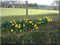
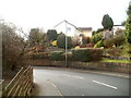
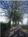
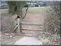
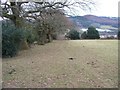
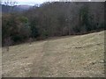
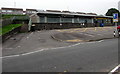

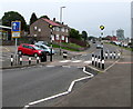
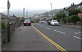
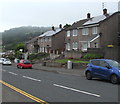
56 photos from this area
Area Information
Key information about the NP11 6RF including its size, population, and administrative classification.
- Area Type
- Postcode
- Area Size
- 3.3 hectares
- Population
- 1810
- Population Density
- 2657 people/km²
House Prices in NP11 6RF
60
Properties
£61,643
Average Sold Price
£4,500
Lowest Price
£158,000
Highest Price
Showing 60 properties
| Address | Type | Beds | Baths | Last Sale Price | Last Sale Date | |
|---|---|---|---|---|---|---|
| 50 Twm Barlwm Close, Trenewydd Park, Risca, NP11 6RF | Terraced | 2 | 1 | £158,000 | Sep 2025 | |
| 15 Twm Barlwm Close, Trenewydd Park, Risca, NP11 6RF | Terraced | 2 | 1 | £125,000 | Oct 2021 | |
| 46 Twm Barlwm Close, Trenewydd Park, Risca, NP11 6RF | Terraced | 2 | 1 | £115,000 | Oct 2020 | |
| 17 Twm Barlwm Close, Trenewydd Park, Risca, NP11 6RF | Semi-detached | 1 | - | £89,950 | Apr 2019 | |
| 22 Twm Barlwm Close, Trenewydd Park, Risca, NP11 6RF | Flat | - | - | £4,500 | Oct 2018 | |
| 27 Twm Barlwm Close, Trenewydd Park, Risca, NP11 6RF | Terraced | 1 | 1 | £69,950 | Dec 2017 | |
| 4 Twm Barlwm Close, Trenewydd Park, Risca, NP11 6RF | Terraced | 1 | 1 | £70,000 | Aug 2017 | |
| 16 Twm Barlwm Close, Trenewydd Park, Risca, NP11 6RF | Semi-detached | 1 | 1 | £69,000 | May 2017 | |
| 14 Twm Barlwm Close, Trenewydd Park, Risca, NP11 6RF | Terraced | 2 | 1 | £86,000 | Jun 2015 | |
| 47 Twm Barlwm Close, Trenewydd Park, Risca, NP11 6RF | Detached | 1 | 1 | £65,000 | May 2015 |
Page 1 of 6
Energy Efficiency in NP11 6RF
Amenities
Schools
| Rank | School | Type | Entry gender | Ages |
|---|
Explore more schools in this area
Go to Schools tabDemographics
Household Size
One person
most common
Accommodation Type
Houses
most common
Tenure
63
majority
Ethnic Group
White
most common
Religion
N/A
most common
Household Composition
N/A
most common
Age
47
median
Adults (30-64 years)
most common
Household Deprivation
N/A
with no deprivation
NS-SEC
24
in Lower managerial occupations
Explore more demographic insights in this area
Go to Demographics tabPlanning
Planning Constraints
- Flood RiskPremium
- Ramsar Wetland SitesPremium
- Area of Outstanding Natural BeautyPremium
- Protected Nature ReservePremium
- Protected WoodlandPremium
- Crime RiskPremium