Area Overview for NP11 6PB
Photos of NP11 6PB
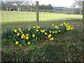
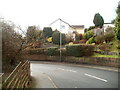
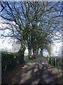
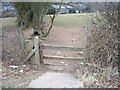

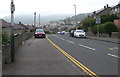
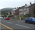
56 photos from this area
Area Information
Key information about the NP11 6PB including its size, population, and administrative classification.
- Area Type
- Postcode
- Area Size
- 9956 m²
- Population
- 1441
- Population Density
- 4439 people/km²
House Prices in NP11 6PB
38
Properties
£99,215
Average Sold Price
£22,200
Lowest Price
£150,000
Highest Price
Showing 38 properties
| Address | Type | Beds | Baths | Last Sale Price | Last Sale Date | |
|---|---|---|---|---|---|---|
| 250 Elm Drive, Ty Sign, Risca, NP11 6PB | Semi-detached | 2 | 1 | £145,000 | Sep 2025 | |
| 214 Elm Drive, Ty Sign, Risca, NP11 6PB | Terraced | 2 | 1 | £147,000 | Jul 2025 | |
| 210 Elm Drive, Ty Sign, Risca, NP11 6PB | Semi-detached | 2 | 1 | £130,000 | Apr 2024 | |
| 222 Elm Drive, Ty Sign, Risca, NP11 6PB | Terraced | 2 | 1 | £150,000 | Mar 2023 | |
| 198 Elm Drive, Ty Sign, Risca, NP11 6PB | house | - | - | £97,000 | Sep 2020 | |
| 194 Elm Drive, Ty Sign, Risca, NP11 6PB | Semi-detached | 2 | 1 | £95,000 | Aug 2019 | |
| 204 Elm Drive, Ty Sign, Risca, NP11 6PB | Semi-detached | 2 | 1 | £75,000 | Dec 2017 | |
| 200 Elm Drive, Ty Sign, Risca, NP11 6PB | Semi-detached | - | - | £95,950 | Sep 2007 | |
| 242 Elm Drive, Ty Sign, Risca, NP11 6PB | house | - | - | £22,200 | May 2004 | |
| 220 Elm Drive, Ty Sign, Risca, NP11 6PB | Semi-detached | - | - | £35,000 | Sep 2001 |
Page 1 of 4
Energy Efficiency in NP11 6PB
Amenities
Schools
| Rank | School | Type | Entry gender | Ages |
|---|
Explore more schools in this area
Go to Schools tabDemographics
Household Size
Two person
most common
Accommodation Type
Houses
most common
Tenure
57
majority
Ethnic Group
White
most common
Religion
N/A
most common
Household Composition
N/A
most common
Age
47
median
Adults (30-64 years)
most common
Household Deprivation
N/A
with no deprivation
NS-SEC
19
in Lower managerial occupations
Explore more demographic insights in this area
Go to Demographics tabPlanning
Planning Constraints
- Flood RiskPremium
- Ramsar Wetland SitesPremium
- Area of Outstanding Natural BeautyPremium
- Protected Nature ReservePremium
- Protected WoodlandPremium
- Crime RiskPremium