Area Overview for NP11 5AY
Photos of NP11 5AY
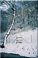
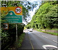
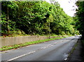
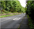
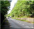
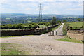
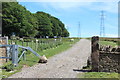
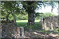
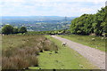
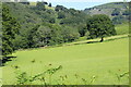
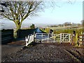
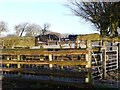
15 photos from this area
Area Information
Key information about the NP11 5AY including its size, population, and administrative classification.
- Area Type
- Postcode
- Area Size
- 1.6 km²
- Population
- 1472
- Population Density
- 262 people/km²
House Prices in NP11 5AY
8
Properties
-
Average Sold Price
-
Lowest Price
-
Highest Price
Showing 8 properties
| Address | Type | Beds | Baths | Last Sale Price | Last Sale Date | |
|---|---|---|---|---|---|---|
| Pen Y Caeau Farm, Abercarn Mountain Road, Hafodyrynys, NP11 5AY | Semi-detached | 4 | 2 | - | - | |
| The Barn, Pen Y Caeau Farm, Abercarn Mountain Road, Hafodyrynys, NP11 5AY | Detached | 4 | 2 | - | - | |
| Blaengawney Farm, Blaengawney Farm Lane, Hafodyrynys, NP11 5AY | house | - | - | - | - | |
| Ty Oakley Farm, Abercarn Mountain Road, Hafodyrynys, NP11 5AY | house | - | - | - | - | |
| Cefn-rhos-y-bedd-uchaf, Cefn Rhos Y Bedd Uchaf Farm Lane, Hafodyrynys, NP11 5AY | Detached | - | - | - | - | |
| Cil Lonydd Farm, Abercarn Mountain Road, Hafodyrynys, NP11 5AY | Farm | - | - | - | - | |
| Cefn Gawni, Blaengawney Farm, Blaengawney Farm Lane, Hafodyrynys, NP11 5AY | Detached | - | - | - | - | |
| Hallets Real Cider, Cider Shed, Blaengawney Farm, Blaengawney Farm Lane, Hafodyrynys, NP11 5AY | Industrial | - | - | - | - |
Energy Efficiency in NP11 5AY
Amenities
Schools
| Rank | School | Type | Entry gender | Ages |
|---|
Explore more schools in this area
Go to Schools tabDemographics
Household Size
Family (3-5 people)
most common
Accommodation Type
Houses
most common
Tenure
50
majority
Ethnic Group
White
most common
Religion
N/A
most common
Household Composition
N/A
most common
Age
47
median
Adults (30-64 years)
most common
Household Deprivation
N/A
with no deprivation
NS-SEC
15
in Lower managerial occupations
Explore more demographic insights in this area
Go to Demographics tabPlanning
Planning Constraints
- Flood RiskPremium
- Ramsar Wetland SitesPremium
- Area of Outstanding Natural BeautyPremium
- Protected Nature ReservePremium
- Protected WoodlandPremium
- Crime RiskPremium