Area Overview for NP11 4RS
Photos of NP11 4RS


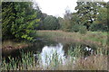
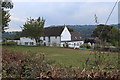
34 photos from this area
Area Information
Key information about the NP11 4RS including its size, population, and administrative classification.
- Area Type
- Postcode
- Area Size
- 1.9 hectares
- Population
- 1189
- Population Density
- 2679 people/km²
House Prices in NP11 4RS
34
Properties
£131,700
Average Sold Price
£34,500
Lowest Price
£225,000
Highest Price
Showing 34 properties
| Address | Type | Beds | Baths | Last Sale Price | Last Sale Date | |
|---|---|---|---|---|---|---|
| 9 Manor Park, Newbridge, NP11 4RS | Semi-detached | 2 | 2 | £225,000 | Jun 2024 | |
| 5 Manor Park, Newbridge, NP11 4RS | Bungalow | - | - | £165,000 | Oct 2021 | |
| 25 Manor Park, Newbridge, NP11 4RS | Bungalow | - | - | £215,000 | Jun 2019 | |
| 24 Manor Park, Newbridge, NP11 4RS | house | - | - | £100,000 | Mar 2013 | |
| 2 Manor Park, Newbridge, NP11 4RS | Bungalow | 3 | - | £132,000 | May 2011 | |
| 15 Manor Park, Newbridge, NP11 4RS | Semi-detached | - | - | £150,000 | Jan 2006 | |
| 29 Manor Park, Newbridge, NP11 4RS | Semi-detached | - | - | £168,000 | Apr 2005 | |
| 10 Manor Park, Newbridge, NP11 4RS | Semi-detached | - | - | £34,500 | Dec 2004 | |
| 16 Manor Park, Newbridge, NP11 4RS | Detached | 4 | 2 | £68,000 | Nov 1999 | |
| 14 Manor Park, Newbridge, NP11 4RS | Semi-detached | - | - | £59,500 | May 1995 |
Page 1 of 4
Energy Efficiency in NP11 4RS
Amenities
Schools
| Rank | School | Type | Entry gender | Ages |
|---|
Explore more schools in this area
Go to Schools tabDemographics
Household Size
Family (3-5 people)
most common
Accommodation Type
Houses
most common
Tenure
88
majority
Ethnic Group
White
most common
Religion
N/A
most common
Household Composition
N/A
most common
Age
47
median
Adults (30-64 years)
most common
Household Deprivation
N/A
with no deprivation
NS-SEC
25
in Lower managerial occupations
Explore more demographic insights in this area
Go to Demographics tabPlanning
Planning Constraints
- Flood RiskPremium
- Ramsar Wetland SitesPremium
- Area of Outstanding Natural BeautyPremium
- Protected Nature ReservePremium
- Protected WoodlandPremium
- Crime RiskPremium