Area Overview for NP11 4HJ
Photos of NP11 4HJ

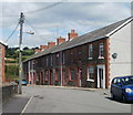
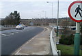
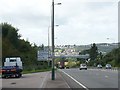
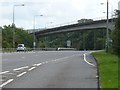
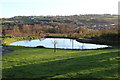
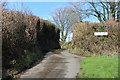
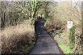
88 photos from this area
Area Information
Key information about the NP11 4HJ including its size, population, and administrative classification.
- Area Type
- Postcode
- Area Size
- 2.1 hectares
- Population
- 1784
- Population Density
- 843 people/km²
House Prices in NP11 4HJ
21
Properties
£176,850
Average Sold Price
£42,000
Lowest Price
£495,000
Highest Price
Showing 21 properties
| Address | Type | Beds | Baths | Last Sale Price | Last Sale Date | |
|---|---|---|---|---|---|---|
| 6 Tonypistyll Road, Pentwyn Mawr, NP11 4HJ | house | - | - | £169,950 | Sep 2025 | |
| 3 Tonypistyll Road, Pentwyn Mawr, NP11 4HJ | Terraced | 3 | 1 | £106,000 | Sep 2024 | |
| 4 Tonypistyll Road, Pentwyn Mawr, NP11 4HJ | Terraced | 4 | 1 | £161,000 | May 2024 | |
| 1 Tonypistyll Road, Pentwyn Mawr, NP11 4HJ | Terraced | 3 | - | £145,000 | Oct 2023 | |
| 9 Tonypistyll Road, Pentwyn Mawr, NP11 4HJ | house | - | - | £123,000 | Apr 2020 | |
| 12 Tonypistyll Road, Pentwyn Mawr, NP11 4HJ | Terraced | 2 | 1 | £101,000 | Jan 2020 | |
| 10 Tonypistyll Road, Pentwyn Mawr, NP11 4HJ | Terraced | 2 | - | £120,000 | Jan 2020 | |
| Hillcroft, Tonypistyll Road, Pentwyn Mawr, NP11 4HJ | Bungalow | 4 | 2 | £370,000 | Sep 2019 | |
| Wymor Bungalow, Tonypistyll Road, Pentwyn Mawr, NP11 4HJ | Bungalow | 3 | 1 | £285,000 | Aug 2019 | |
| The Gables, Tonypistyll Road, Pentwyn Mawr, NP11 4HJ | house | - | - | £495,000 | Jan 2008 |
Page 1 of 3
Energy Efficiency in NP11 4HJ
Amenities
Schools
| Rank | School | Type | Entry gender | Ages |
|---|
Explore more schools in this area
Go to Schools tabDemographics
Household Size
Two person
most common
Accommodation Type
Houses
most common
Tenure
76
majority
Ethnic Group
White
most common
Religion
N/A
most common
Household Composition
N/A
most common
Age
47
median
Adults (30-64 years)
most common
Household Deprivation
N/A
with no deprivation
NS-SEC
30
in Lower managerial occupations
Explore more demographic insights in this area
Go to Demographics tabPlanning
Planning Constraints
- Flood RiskPremium
- Ramsar Wetland SitesPremium
- Area of Outstanding Natural BeautyPremium
- Protected Nature ReservePremium
- Protected WoodlandPremium
- Crime RiskPremium