Area Overview for NP11 3DF
Photos of NP11 3DF
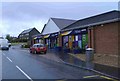
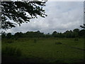
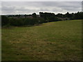
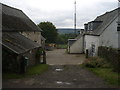
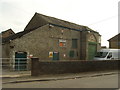
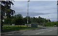
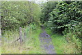
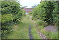
78 photos from this area
Area Information
Key information about the NP11 3DF including its size, population, and administrative classification.
- Area Type
- Postcode
- Area Size
- 1.2 hectares
- Population
- 1695
- Population Density
- 311 people/km²
House Prices in NP11 3DF
30
Properties
£117,608
Average Sold Price
£49,000
Lowest Price
£190,000
Highest Price
Showing 30 properties
| Address | Type | Beds | Baths | Last Sale Price | Last Sale Date | |
|---|---|---|---|---|---|---|
| 9 Cherry Grove, Croespenmaen, NP11 3DF | Bungalow | 3 | 1 | £169,000 | Apr 2024 | |
| 13 Cherry Grove, Croespenmaen, NP11 3DF | Detached | 3 | 1 | £190,000 | Dec 2023 | |
| 5 Cherry Grove, Croespenmaen, NP11 3DF | house | - | - | £165,000 | Feb 2022 | |
| 10 Cherry Grove, Croespenmaen, NP11 3DF | Semi-detached | 3 | 1 | £155,000 | Oct 2018 | |
| 11 Cherry Grove, Croespenmaen, NP11 3DF | Semi-detached | 3 | 1 | £159,950 | Dec 2017 | |
| 22 Cherry Grove, Croespenmaen, NP11 3DF | house | - | - | £158,500 | Aug 2017 | |
| 4 Cherry Grove, Croespenmaen, NP11 3DF | house | - | - | £148,000 | Dec 2013 | |
| 1 Cherry Grove, Croespenmaen, NP11 3DF | house | - | - | £120,000 | Jul 2013 | |
| 18 Cherry Grove, Croespenmaen, NP11 3DF | Semi-detached | - | - | £54,950 | Sep 2001 | |
| 23 Cherry Grove, Croespenmaen, NP11 3DF | Semi-detached | - | - | £59,500 | Oct 1999 |
Page 1 of 3
Energy Efficiency in NP11 3DF
Amenities
Schools
| Rank | School | Type | Entry gender | Ages |
|---|
Explore more schools in this area
Go to Schools tabDemographics
Household Size
Family (3-5 people)
most common
Accommodation Type
Houses
most common
Tenure
76
majority
Ethnic Group
White
most common
Religion
N/A
most common
Household Composition
N/A
most common
Age
47
median
Adults (30-64 years)
most common
Household Deprivation
N/A
with no deprivation
NS-SEC
32
in Lower managerial occupations
Explore more demographic insights in this area
Go to Demographics tabPlanning
Planning Constraints
- Flood RiskPremium
- Ramsar Wetland SitesPremium
- Area of Outstanding Natural BeautyPremium
- Protected Nature ReservePremium
- Protected WoodlandPremium
- Crime RiskPremium