Area Overview for CF83 8ER
Photos of CF83 8ER
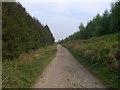
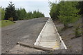


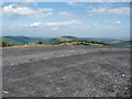

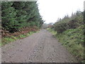
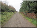
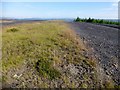
10 photos from this area
Area Information
Key information about the CF83 8ER including its size, population, and administrative classification.
- Area Type
- Postcode
- Area Size
- 4.5 km²
- Population
- 1871
- Population Density
- 226 people/km²
House Prices in CF83 8ER
14
Properties
£115,725
Average Sold Price
£1,500
Lowest Price
£229,950
Highest Price
Showing 14 properties
| Address | Type | Beds | Baths | Last Sale Price | Last Sale Date | |
|---|---|---|---|---|---|---|
| Ty Maen Farm, Mountain Road, Bedwas, CF83 8ER | Detached | 5 | - | £1,500 | Apr 2017 | |
| Stonecroft, Mountain Road, Bedwas, CF83 8ER | Bungalow | 3 | 1 | £229,950 | Jul 2002 | |
| Ty Pen-y-waun, Mountain Road, Bedwas, CF83 8ER | Detached | 4 | - | - | - | |
| Tynycwm Farm, Mountain Road, Bedwas, CF83 8ER | Detached | - | - | - | - | |
| The Stables, Mountain Road, Bedwas, CF83 8ER | house | - | - | - | - | |
| Old Ty Maen, Mountain Road, Bedwas, CF83 8ER | Detached | - | - | - | - | |
| Caravan 2, Wyth-erw Farm, Mountain Road, Bedwas, CF83 8ER | Mobile Home | - | - | - | - | |
| Caravan 1, Wyth-erw Farm, Mountain Road, Bedwas, CF83 8ER | Detached | 4 | 3 | - | - | |
| Llwynllynfa, Mountain Road, Bedwas, CF83 8ER | house | - | - | - | - | |
| Ysgubor-y-twbyn, Colliery Road, Bedwas, CF83 8ER | Equestrian | - | - | - | - |
Page 1 of 2
Energy Efficiency in CF83 8ER
Amenities
Schools
| Rank | School | Type | Entry gender | Ages |
|---|
Explore more schools in this area
Go to Schools tabDemographics
Household Size
Two person
most common
Accommodation Type
Houses
most common
Tenure
87
majority
Ethnic Group
White
most common
Religion
N/A
most common
Household Composition
N/A
most common
Age
47
median
Adults (30-64 years)
most common
Household Deprivation
N/A
with no deprivation
NS-SEC
40
in Lower managerial occupations
Explore more demographic insights in this area
Go to Demographics tabPlanning
Planning Constraints
- Flood RiskPremium
- Ramsar Wetland SitesPremium
- Area of Outstanding Natural BeautyPremium
- Protected Nature ReservePremium
- Protected WoodlandPremium
- Crime RiskPremium