Area Overview for CF83 3HA
Photos of CF83 3HA

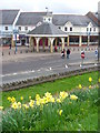
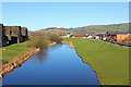
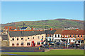
100 photos from this area
Area Information
Key information about the CF83 3HA including its size, population, and administrative classification.
- Area Type
- Postcode
- Area Size
- 4936 m²
- Population
- 1940
- Population Density
- 3115 people/km²
House Prices in CF83 3HA
19
Properties
£130,716
Average Sold Price
£32,950
Lowest Price
£255,000
Highest Price
Showing 19 properties
| Address | Type | Beds | Baths | Last Sale Price | Last Sale Date | |
|---|---|---|---|---|---|---|
| 68 Pontygwindy Road, Caerphilly, CF83 3HA | Terraced | 3 | 2 | £255,000 | Mar 2025 | |
| 62 Pontygwindy Road, Caerphilly, CF83 3HA | Terraced | 3 | 1 | £206,000 | Aug 2023 | |
| 64 Pontygwindy Road, Caerphilly, CF83 3HA | Terraced | 3 | 1 | £190,000 | Jun 2022 | |
| 60 Pontygwindy Road, Caerphilly, CF83 3HA | Terraced | 3 | - | £170,000 | Nov 2015 | |
| 70 Pontygwindy Road, Caerphilly, CF83 3HA | house | - | - | £115,000 | Feb 2012 | |
| 88 Pontygwindy Road, Caerphilly, CF83 3HA | house | - | - | £122,000 | Aug 2006 | |
| 96 Pontygwindy Road, Caerphilly, CF83 3HA | Terraced | - | - | £37,500 | Aug 2001 | |
| 80 Pontygwindy Road, Caerphilly, CF83 3HA | Terraced | - | - | £47,995 | Apr 2000 | |
| 94 Pontygwindy Road, Caerphilly, CF83 3HA | Terraced | - | - | £32,950 | Apr 1996 | |
| 86 Pontygwindy Road, Caerphilly, CF83 3HA | Terraced | 3 | 1 | - | - |
Page 1 of 2
Energy Efficiency in CF83 3HA
Amenities
Schools
| Rank | School | Type | Entry gender | Ages |
|---|
Explore more schools in this area
Go to Schools tabDemographics
Household Size
Family (3-5 people)
most common
Accommodation Type
Houses
most common
Tenure
74
majority
Ethnic Group
White
most common
Religion
N/A
most common
Household Composition
N/A
most common
Age
47
median
Adults (30-64 years)
most common
Household Deprivation
N/A
with no deprivation
NS-SEC
30
in Lower managerial occupations
Explore more demographic insights in this area
Go to Demographics tabPlanning
Planning Constraints
- Flood RiskPremium
- Ramsar Wetland SitesPremium
- Area of Outstanding Natural BeautyPremium
- Protected Nature ReservePremium
- Protected WoodlandPremium
- Crime RiskPremium