Area Overview for CF83 3DP
Photos of CF83 3DP
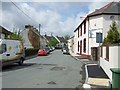
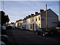
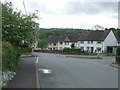
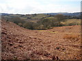
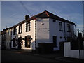
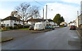
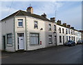
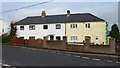
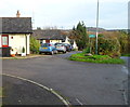
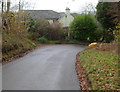
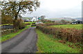
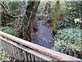
17 photos from this area
Area Information
Key information about the CF83 3DP including its size, population, and administrative classification.
- Area Type
- Postcode
- Area Size
- 3592 m²
- Population
- 1599
- Population Density
- 63 people/km²
House Prices in CF83 3DP
15
Properties
£149,688
Average Sold Price
£48,500
Lowest Price
£225,000
Highest Price
Showing 15 properties
| Address | Type | Beds | Baths | Last Sale Price | Last Sale Date | |
|---|---|---|---|---|---|---|
| Gwyn-y-garth Cottage, Starbuck Street, Rudry, CF83 3DP | Terraced | 3 | - | £200,000 | May 2023 | |
| 8 Starbuck Street, Rudry, CF83 3DP | house | - | - | £225,000 | Mar 2021 | |
| 5 Starbuck Street, Rudry, CF83 3DP | Terraced | 3 | 1 | £218,000 | Oct 2018 | |
| 4 Starbuck Street, Rudry, CF83 3DP | Terraced | 3 | 1 | £140,000 | Nov 2017 | |
| Ty Bwyta, Starbuck Street, Rudry, CF83 3DP | house | 2 | 1 | £150,000 | Mar 2016 | |
| 2 Starbuck Street, Rudry, CF83 3DP | Terraced | 3 | - | £170,500 | Sep 2015 | |
| 3 Starbuck Street, Rudry, CF83 3DP | house | - | - | £156,000 | Oct 2014 | |
| 9 Starbuck Street, Rudry, CF83 3DP | house | - | - | £159,950 | Sep 2010 | |
| 6 Starbuck Street, Rudry, CF83 3DP | Terraced | - | - | £163,000 | Jun 2008 | |
| 13 Starbuck Street, Rudry, CF83 3DP | Flat | - | - | £90,000 | Feb 2007 |
Page 1 of 2
Energy Efficiency in CF83 3DP
Amenities
Schools
| Rank | School | Type | Entry gender | Ages |
|---|
Explore more schools in this area
Go to Schools tabDemographics
Household Size
Two person
most common
Accommodation Type
Houses
most common
Tenure
79
majority
Ethnic Group
White
most common
Religion
N/A
most common
Household Composition
N/A
most common
Age
47
median
Adults (30-64 years)
most common
Household Deprivation
N/A
with no deprivation
NS-SEC
42
in Lower managerial occupations
Explore more demographic insights in this area
Go to Demographics tabPlanning
Planning Constraints
- Flood RiskPremium
- Ramsar Wetland SitesPremium
- Area of Outstanding Natural BeautyPremium
- Protected Nature ReservePremium
- Protected WoodlandPremium
- Crime RiskPremium