Area Overview for CF83 1UG
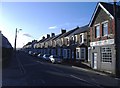
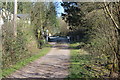
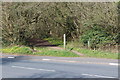
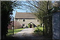
Photos of CF83 1UG


Area Information
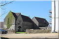
CF83 1UG is a small residential cluster in Wales, covering just 2.5 hectares and home to 1,736 people. With a population density of 913 people per square kilometre, it’s a compact, closely knit community. Situated near Caerphilly Castle, one of Britain’s largest medieval fortifications, the area blends historical significance with modern living. The postcode lies on the southern edge of the South Wales coalfield, a region shaped by industrial history but now focused on residential stability. Daily life here is defined by proximity to local amenities, schools, and transport links. The area’s compact size means residents are likely to know their neighbours, while the surrounding landscape offers a mix of historical sites and practical infrastructure. For buyers, CF83 1UG represents a balance of heritage and convenience, with homes predominantly in private ownership and a community skewed toward middle-aged adults. Its location near rail stations and retail hubs adds to its appeal, though the flood risk and protected woodland nearby require careful consideration.
- Area Type
- Postcode
- Area Size
- 2.5 hectares
- Population
- 1736
- Population Density
- 913 people/km²
The property market in CF83 1UG is dominated by private homeownership, with 77% of homes owned by residents rather than rented. This reflects a community prioritising long-term investment over rental flexibility. The accommodation type is predominantly houses, which is unusual for areas with high population density. This suggests a mix of semi-detached or terraced housing, possibly built to accommodate the local population’s needs. Given the small area size (2.5 hectares), the housing stock is likely limited, making CF83 1UG a niche market for buyers seeking established properties in a compact, historically rich setting. The high home ownership rate also indicates low turnover, which could mean fewer opportunities for new buyers but greater stability in property values. Those considering the area should factor in proximity to schools, transport, and the local environment, which may influence both desirability and resale potential.
House Prices in CF83 1UG
No properties found in this postcode.
Energy Efficiency in CF83 1UG
Residents of CF83 1UG have access to a range of amenities within practical reach. Retail options include Morrisons Pontypandy, Heron Caerphilly, and Iceland Caerphilly, offering everyday shopping needs. The area’s rail network connects to five stations, including Caerphilly Railway Station and Energlyn & Churchill Park Railway Station, facilitating travel to nearby employment hubs. A ferry service to Cardiff Castle Waterbus Stop adds a unique dimension, linking the community to cultural and recreational opportunities in Cardiff. The presence of multiple retail outlets and transport links suggests a lifestyle that balances convenience with connectivity. While the area’s small size limits the diversity of amenities, the proximity to larger towns and cities via rail and ferry compensates. This makes CF83 1UG a practical choice for those valuing accessibility without sacrificing a sense of local community.
Amenities
Schools
Residents of CF83 1UG have access to three primary schools: Twyn Junior School, Twyn Infants School, and Twyn Primary School. All are listed as “other” in the data, though no Ofsted ratings are provided. The presence of three schools suggests a focus on early education, likely catering to young families in the area. The clustering of primary schools within a small postcode indicates a community where children are likely to attend local institutions, reducing the need for long commutes. However, the absence of secondary schools or higher education facilities means families may need to look further afield for secondary education. The mix of school types, all primary, supports the area’s demographic of middle-aged adults and families with younger children. The lack of detailed ratings or specific curricular information leaves room for further research, but the availability of multiple schools is a clear advantage for parents.
| Rank | School | Type | Entry gender | Ages |
|---|
Explore more schools in this area
Go to Schools tabDemographics
The population of CF83 1UG has a median age of 47, with the majority of residents aged between 30 and 64. This suggests a community of established professionals and families, rather than a younger or elderly demographic. Home ownership is high, at 77%, indicating a stable, long-term resident base. The accommodation type is predominantly houses, which aligns with the area’s residential character. The predominant ethnic group is White, reflecting the broader demographic trends in the region. With 913 people per square kilometre, the density is high for such a small area, implying a mix of family homes and possibly multi-generational living. The age profile and ownership rates suggest a community focused on continuity rather than rapid change. However, the lack of diversity data means the full range of cultural or socioeconomic factors influencing daily life here remains unclear.
Household Size
Accommodation Type
Tenure
Ethnic Group
Religion
Household Composition
Age
Household Deprivation
NS-SEC
Explore more demographic insights in this area
Go to Demographics tabPlanning
Planning Constraints
- Flood RiskPremium
- Ramsar Wetland SitesPremium
- Area of Outstanding Natural BeautyPremium
- Protected Nature ReservePremium
- Protected WoodlandPremium
- Crime RiskPremium