Area Overview for CF83 1SQ
Photos of CF83 1SQ
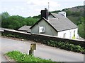
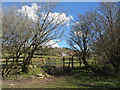
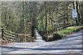
37 photos from this area
Area Information
Key information about the CF83 1SQ including its size, population, and administrative classification.
- Area Type
- Postcode
- Area Size
- 9559 m²
- Population
- 1459
- Population Density
- 383 people/km²
House Prices in CF83 1SQ
13
Properties
£181,958
Average Sold Price
£22,000
Lowest Price
£347,000
Highest Price
Showing 13 properties
| Address | Type | Beds | Baths | Last Sale Price | Last Sale Date | |
|---|---|---|---|---|---|---|
| 1 Clos Caer Wern, Caerphilly, CF83 1SQ | Detached | 4 | - | £347,000 | Dec 2020 | |
| 3 Clos Caer Wern, Caerphilly, CF83 1SQ | house | 3 | - | £271,000 | Feb 2020 | |
| 9 Clos Caer Wern, Caerphilly, CF83 1SQ | Detached | 6 | - | £300,000 | Jul 2017 | |
| 12 Clos Caer Wern, Caerphilly, CF83 1SQ | house | - | - | £280,000 | Oct 2014 | |
| 7 Clos Caer Wern, Caerphilly, CF83 1SQ | house | - | - | £240,000 | Sep 2014 | |
| 6 Clos Caer Wern, Caerphilly, CF83 1SQ | house | 4 | - | £218,000 | Sep 2013 | |
| 8 Clos Caer Wern, Caerphilly, CF83 1SQ | Detached | 4 | 2 | £174,950 | Sep 2002 | |
| 5 Clos Caer Wern, Caerphilly, CF83 1SQ | Detached | - | - | £117,000 | Jun 2002 | |
| 11 Clos Caer Wern, Caerphilly, CF83 1SQ | Detached | 4 | 2 | £118,000 | Nov 2001 | |
| 2 Clos Caer Wern, Caerphilly, CF83 1SQ | house | 4 | - | £22,000 | Nov 2001 |
Page 1 of 2
Energy Efficiency in CF83 1SQ
Amenities
Schools
| Rank | School | Type | Entry gender | Ages |
|---|
Explore more schools in this area
Go to Schools tabDemographics
Household Size
Two person
most common
Accommodation Type
Houses
most common
Tenure
89
majority
Ethnic Group
White
most common
Religion
N/A
most common
Household Composition
N/A
most common
Age
47
median
Adults (30-64 years)
most common
Household Deprivation
N/A
with no deprivation
NS-SEC
44
in Lower managerial occupations
Explore more demographic insights in this area
Go to Demographics tabPlanning
Planning Constraints
- Flood RiskPremium
- Ramsar Wetland SitesPremium
- Area of Outstanding Natural BeautyPremium
- Protected Nature ReservePremium
- Protected WoodlandPremium
- Crime RiskPremium