Area Overview for CF82 7LY
Photos of CF82 7LY
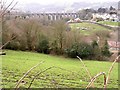
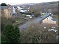
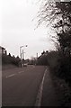
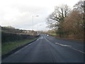
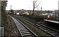
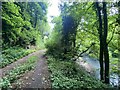
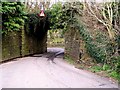
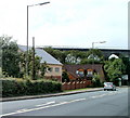
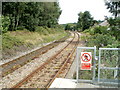
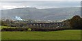
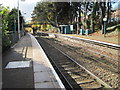

17 photos from this area
Area Information
Key information about the CF82 7LY including its size, population, and administrative classification.
- Area Type
- Postcode
- Area Size
- 1.7 hectares
- Population
- Not available
- Population Density
- Not available
House Prices in CF82 7LY
38
Properties
£113,600
Average Sold Price
£40,000
Lowest Price
£290,000
Highest Price
Showing 38 properties
| Address | Type | Beds | Baths | Last Sale Price | Last Sale Date | |
|---|---|---|---|---|---|---|
| 41 Raglan Road, Hengoed, CF82 7LY | Semi-detached | 4 | 2 | £290,000 | Mar 2025 | |
| 31 Raglan Road, Hengoed, CF82 7LY | Terraced | 3 | 2 | £167,500 | Oct 2022 | |
| 57 Raglan Road, Hengoed, CF82 7LY | Terraced | 2 | 2 | £140,000 | Oct 2021 | |
| 43 Raglan Road, Hengoed, CF82 7LY | house | - | - | £120,000 | Oct 2021 | |
| 69 Raglan Road, Hengoed, CF82 7LY | Terraced | 3 | 1 | £95,000 | Feb 2019 | |
| 49 Raglan Road, Hengoed, CF82 7LY | house | - | - | £81,500 | Oct 2017 | |
| 35 Raglan Road, Hengoed, CF82 7LY | Terraced | 3 | 2 | £104,000 | Aug 2017 | |
| 47 Raglan Road, Hengoed, CF82 7LY | Terraced | 3 | 1 | £84,000 | Aug 2016 | |
| 29 Raglan Road, Hengoed, CF82 7LY | Terraced | 4 | - | £105,000 | Nov 2015 | |
| 33 Raglan Road, Hengoed, CF82 7LY | Terraced | 3 | 1 | £110,000 | Sep 2015 |
Page 1 of 4
Energy Efficiency in CF82 7LY
Amenities
Schools
| Rank | School | Type | Entry gender | Ages |
|---|
Explore more schools in this area
Go to Schools tabDemographics
Household Size
Family (3-5 people)
most common
Accommodation Type
Houses
most common
Tenure
72
majority
Ethnic Group
White
most common
Religion
N/A
most common
Household Composition
N/A
most common
Age
47
median
Adults (30-64 years)
most common
Household Deprivation
N/A
with no deprivation
NS-SEC
29
in Lower managerial occupations
Explore more demographic insights in this area
Go to Demographics tabPlanning
Planning Constraints
- Flood RiskPremium
- Ramsar Wetland SitesPremium
- Area of Outstanding Natural BeautyPremium
- Protected Nature ReservePremium
- Protected WoodlandPremium
- Crime RiskPremium