Area Overview for CF82 7FE
Photos of CF82 7FE
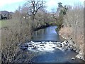
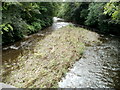
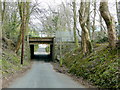


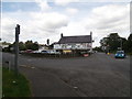


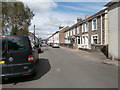
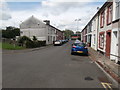
100 photos from this area
Area Information
Key information about the CF82 7FE including its size, population, and administrative classification.
- Area Type
- Postcode
- Area Size
- 1.3 hectares
- Population
- 1373
- Population Density
- 403 people/km²
House Prices in CF82 7FE
28
Properties
£149,360
Average Sold Price
£45,500
Lowest Price
£270,000
Highest Price
Showing 28 properties
| Address | Type | Beds | Baths | Last Sale Price | Last Sale Date | |
|---|---|---|---|---|---|---|
| 23 Ger Nant, Ystrad Mynach, CF82 7FE | Detached | 3 | 1 | £270,000 | Aug 2025 | |
| 17 Ger Nant, Ystrad Mynach, CF82 7FE | Terraced | 3 | 1 | £235,000 | Mar 2025 | |
| 8 Ger Nant, Ystrad Mynach, CF82 7FE | Detached | 3 | 1 | £262,000 | Aug 2022 | |
| 7 Ger Nant, Ystrad Mynach, CF82 7FE | Semi-detached | 3 | 1 | £226,000 | Nov 2021 | |
| 10 Ger Nant, Ystrad Mynach, CF82 7FE | house | - | - | £228,000 | Apr 2021 | |
| 2 Ger Nant, Ystrad Mynach, CF82 7FE | house | - | - | £260,000 | Oct 2018 | |
| 24 Ger Nant, Ystrad Mynach, CF82 7FE | Detached | 4 | 2 | £222,500 | Sep 2018 | |
| 16 Ger Nant, Ystrad Mynach, CF82 7FE | house | - | - | £200,000 | Sep 2017 | |
| 18 Ger Nant, Ystrad Mynach, CF82 7FE | Detached | 3 | 2 | £173,000 | Sep 2015 | |
| 31 Ger Nant, Ystrad Mynach, CF82 7FE | house | - | - | £198,000 | Jun 2014 |
Page 1 of 3
Energy Efficiency in CF82 7FE
Amenities
Schools
| Rank | School | Type | Entry gender | Ages |
|---|
Explore more schools in this area
Go to Schools tabDemographics
Household Size
Family (3-5 people)
most common
Accommodation Type
Houses
most common
Tenure
89
majority
Ethnic Group
White
most common
Religion
N/A
most common
Household Composition
N/A
most common
Age
47
median
Adults (30-64 years)
most common
Household Deprivation
N/A
with no deprivation
NS-SEC
43
in Lower managerial occupations
Explore more demographic insights in this area
Go to Demographics tabPlanning
Planning Constraints
- Flood RiskPremium
- Ramsar Wetland SitesPremium
- Area of Outstanding Natural BeautyPremium
- Protected Nature ReservePremium
- Protected WoodlandPremium
- Crime RiskPremium