Area Overview for CF82 7EW
Photos of CF82 7EW
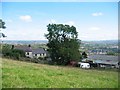
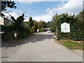
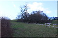
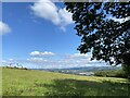
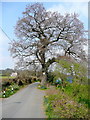
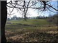
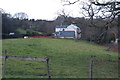
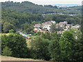
9 photos from this area
Area Information
Key information about the CF82 7EW including its size, population, and administrative classification.
- Area Type
- Postcode
- Area Size
- 75.9 hectares
- Population
- 1373
- Population Density
- 403 people/km²
House Prices in CF82 7EW
7
Properties
£301,250
Average Sold Price
£15,000
Lowest Price
£790,000
Highest Price
Showing 7 properties
| Address | Type | Beds | Baths | Last Sale Price | Last Sale Date | |
|---|---|---|---|---|---|---|
| Troedyrhiw Farm, Twyn Road, Ystrad Mynach, CF82 7EW | Detached | 4 | 2 | £790,000 | Dec 2024 | |
| Ashmere Bungalow, Twyn Road, Ystrad Mynach, CF82 7EW | Bungalow | 3 | - | £250,000 | Aug 2017 | |
| Windsor House, Twyn Road, Ystrad Mynach, CF82 7EW | Detached | - | - | £15,000 | Sep 2016 | |
| Brynteg, Twyn Road, Ystrad Mynach, CF82 7EW | house | - | - | £150,000 | Jul 2008 | |
| Woodfields Nursery And Plant Centre, Twyn Road, Ystrad Mynach, CF82 7EW | shop | - | - | - | - | |
| Woodlands, Twyn Road, Ystrad Mynach, CF82 7EW | Semi-detached | - | - | - | - | |
| Derwen Deg, Twyn Road, Ystrad Mynach, CF82 7EW | Semi-detached | - | - | - | - |
Energy Efficiency in CF82 7EW
Amenities
Schools
| Rank | School | Type | Entry gender | Ages |
|---|
Explore more schools in this area
Go to Schools tabDemographics
Household Size
Family (3-5 people)
most common
Accommodation Type
Houses
most common
Tenure
89
majority
Ethnic Group
White
most common
Religion
N/A
most common
Household Composition
N/A
most common
Age
47
median
Adults (30-64 years)
most common
Household Deprivation
N/A
with no deprivation
NS-SEC
43
in Lower managerial occupations
Explore more demographic insights in this area
Go to Demographics tabPlanning
Planning Constraints
- Flood RiskPremium
- Ramsar Wetland SitesPremium
- Area of Outstanding Natural BeautyPremium
- Protected Nature ReservePremium
- Protected WoodlandPremium
- Crime RiskPremium