Area Overview for CF81 9QS
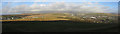
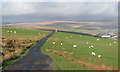
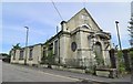
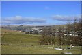
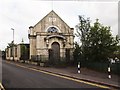
Photos of CF81 9QS
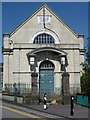
![Southend Terrace, Pontlottyn [2] in CF81 9QS](https://images.propbar.co.uk/images/geograph/11/61/1161099_120.jpg)
100 photos from this area
Area Information
Key information about the CF81 9QS including its size, population, and administrative classification.
- Area Type
- Postcode
- Area Size
- 9908 m²
- Population
- 1832
- Population Density
- 754 people/km²
House Prices in CF81 9QS
33
Properties
£68,958
Average Sold Price
£10,000
Lowest Price
£135,000
Highest Price
Showing 33 properties
| Address | Type | Beds | Baths | Last Sale Price | Last Sale Date | |
|---|---|---|---|---|---|---|
| 62 Brynglas, Pontlottyn, CF81 9QS | house | - | - | £135,000 | May 2024 | |
| 12 Brynglas, Pontlottyn, CF81 9QS | Terraced | 3 | 1 | £130,000 | Oct 2023 | |
| 54 Brynglas, Pontlottyn, CF81 9QS | house | - | - | £85,000 | Jun 2022 | |
| 32 Brynglas, Pontlottyn, CF81 9QS | house | - | - | £70,000 | Apr 2022 | |
| 28 Brynglas, Pontlottyn, CF81 9QS | house | - | - | £69,000 | Sep 2020 | |
| 66 Brynglas, Pontlottyn, CF81 9QS | house | - | - | £50,000 | Mar 2020 | |
| 64 Brynglas, Pontlottyn, CF81 9QS | Terraced | 3 | 1 | £76,000 | Oct 2019 | |
| 24 Brynglas, Pontlottyn, CF81 9QS | Terraced | 3 | 1 | £60,000 | Jan 2019 | |
| 30 Brynglas, Pontlottyn, CF81 9QS | house | - | - | £40,000 | Jul 2014 | |
| 10 Brynglas, Pontlottyn, CF81 9QS | house | - | - | £60,000 | Sep 2005 |
Page 1 of 4
Energy Efficiency in CF81 9QS
Amenities
Schools
| Rank | School | Type | Entry gender | Ages |
|---|
Explore more schools in this area
Go to Schools tabDemographics
Household Size
Two person
most common
Accommodation Type
Houses
most common
Tenure
61
majority
Ethnic Group
White
most common
Religion
N/A
most common
Household Composition
N/A
most common
Age
47
median
Adults (30-64 years)
most common
Household Deprivation
N/A
with no deprivation
NS-SEC
17
in Lower managerial occupations
Explore more demographic insights in this area
Go to Demographics tabPlanning
Planning Constraints
- Flood RiskPremium
- Ramsar Wetland SitesPremium
- Area of Outstanding Natural BeautyPremium
- Protected Nature ReservePremium
- Protected WoodlandPremium
- Crime RiskPremium