Area Overview for CF81 9HX
Photos of CF81 9HX
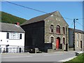
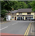
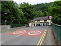
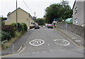
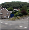
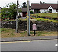
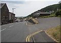
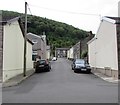
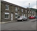
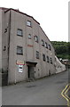
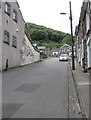
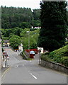
62 photos from this area
Area Information
Key information about the CF81 9HX including its size, population, and administrative classification.
- Area Type
- Postcode
- Area Size
- 3.7 hectares
- Population
- 1291
- Population Density
- 88 people/km²
House Prices in CF81 9HX
32
Properties
£68,882
Average Sold Price
£18,000
Lowest Price
£116,000
Highest Price
Showing 32 properties
| Address | Type | Beds | Baths | Last Sale Price | Last Sale Date | |
|---|---|---|---|---|---|---|
| 113 Bailey Street, Deri, CF81 9HX | Terraced | 2 | 1 | £100,000 | Aug 2025 | |
| 109 Bailey Street, Deri, CF81 9HX | Terraced | 2 | - | £116,000 | Oct 2023 | |
| 125 Bailey Street, Deri, CF81 9HX | Terraced | 2 | 1 | £93,000 | Nov 2022 | |
| 121 Bailey Street, Deri, CF81 9HX | house | - | - | £81,000 | Aug 2022 | |
| 124 Bailey Street, Deri, CF81 9HX | house | 2 | 1 | £60,000 | Feb 2022 | |
| 117 Bailey Street, Deri, CF81 9HX | house | - | - | £60,000 | Nov 2019 | |
| 129 Bailey Street, Deri, CF81 9HX | Terraced | 3 | - | £91,000 | Oct 2019 | |
| 122 Bailey Street, Deri, CF81 9HX | Terraced | 2 | 1 | £70,000 | Nov 2018 | |
| 119 Bailey Street, Deri, CF81 9HX | Terraced | 3 | - | £80,000 | Jul 2017 | |
| 99 Bailey Street, Deri, CF81 9HX | Semi-detached | 3 | 1 | £67,000 | Aug 2016 |
Page 1 of 4
Energy Efficiency in CF81 9HX
Amenities
Schools
| Rank | School | Type | Entry gender | Ages |
|---|
Explore more schools in this area
Go to Schools tabDemographics
Household Size
Family (3-5 people)
most common
Accommodation Type
Houses
most common
Tenure
79
majority
Ethnic Group
White
most common
Religion
N/A
most common
Household Composition
N/A
most common
Age
47
median
Adults (30-64 years)
most common
Household Deprivation
N/A
with no deprivation
NS-SEC
23
in Lower managerial occupations
Explore more demographic insights in this area
Go to Demographics tabPlanning
Planning Constraints
- Flood RiskPremium
- Ramsar Wetland SitesPremium
- Area of Outstanding Natural BeautyPremium
- Protected Nature ReservePremium
- Protected WoodlandPremium
- Crime RiskPremium