Area Overview for CF81 8XD
Photos of CF81 8XD

Area Information
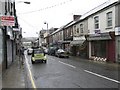
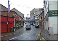
CF81 8XD is a small residential postcode area in Bargoed, a town in the Rhymney Valley of South Wales. With a population of 1,734 spread over 210 square metres, it is one of the most densely populated areas in Wales, at 8,275,606 people per square kilometre. This compact cluster lies within the historic community of Bargoed, which straddles the ancient boundary of Glamorgan and Monmouthshire. The area’s character is shaped by its industrial heritage, including the former colliery that once employed thousands and now hosts a country park. Today, CF81 8XD offers a tight-knit community with easy access to local amenities, rail links, and the Rhymney River. The median age of 47 suggests a mature population, many of whom may have ties to the area’s long-standing industries. Living here means navigating a high-density environment, but with proximity to retail, transport, and green spaces. The area’s small size means residents are likely to know their neighbours, though the lack of major infrastructure or employment hubs may influence daily life. For those seeking a quiet, established community with a focus on local connectivity, CF81 8XD provides a distinct blend of residential density and historical context.
- Area Type
- Postcode
- Area Size
- 210 m²
- Population
- 1734
- Population Density
- 6200 people/km²
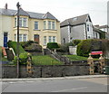
CF81 8XD’s property market is dominated by owner-occupied homes, with 65% of residents owning their properties. The accommodation type is primarily houses, which is unusual for a small, high-density area but may reflect the historical development of Bargoed as a residential hub. This suggests a market where family homes are the norm, though the limited area size means the housing stock is likely constrained. The high home ownership rate indicates a stable community, possibly with fewer rental properties available. Buyers should consider the area’s compact nature, which may limit the availability of larger or newer properties. The focus on houses rather than flats or apartments could appeal to those seeking space, but the lack of detailed data on property prices or market trends means potential buyers must conduct further research. The proximity to rail links and local amenities may offset the area’s density, but the small size of CF81 8XD means competition for available homes could be fierce.
House Prices in CF81 8XD
No properties found in this postcode.
Energy Efficiency in CF81 8XD
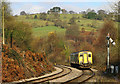
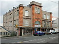
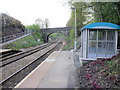
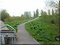
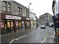
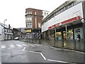
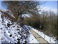
Residents of CF81 8XD have access to a range of local amenities within practical reach. Retail options include Iceland Bargoed, Morrisons Bargoed, and Spar, providing essential shopping and convenience services. The area’s rail stations connect to broader transport networks, facilitating travel to nearby towns and cities. The former colliery site, now a country park, offers green space for recreation, which is a notable feature in a densely populated area. The proximity to the Rhymney River and historical landmarks, such as Bargoed Town Hall, adds to the area’s character. However, the absence of detailed data on dining or leisure facilities means the full extent of local amenities is unclear. The combination of retail, transport, and green space suggests a lifestyle that balances practicality with access to nature. For those prioritising convenience and community, the available amenities support a functional daily life, though the lack of diverse leisure options may require travel beyond the immediate area.
Amenities
Schools
The schools nearest to CF81 8XD include The Graig Junior School, St Gwlady’s Junior School, and St Gwladys Bargoed School. All three are categorised as “other,” though specific Ofsted ratings are not provided in the data. The presence of multiple junior schools suggests a focus on primary education, which may be beneficial for families with young children. However, the lack of secondary schools in the immediate vicinity could require residents to travel further for secondary education. The concentration of junior schools may indicate a localised need for primary education, possibly serving the area’s older demographic. Families considering CF81 8XD should factor in the absence of secondary schools and assess the feasibility of commuting to nearby towns for higher education. The mix of school types does not indicate a comprehensive educational offering, but the availability of junior schools supports the needs of younger residents.
| Rank | School | Type | Entry gender | Ages |
|---|
Explore more schools in this area
Go to Schools tabDemographics
The population of CF81 8XD is predominantly adults aged 30–64, with a median age of 47. This suggests a community of middle-aged residents, many of whom may have long-term ties to the area. Home ownership is high at 65%, indicating a stable demographic with a significant proportion of owner-occupied properties. The accommodation type is primarily houses, which aligns with the older age profile and suggests a preference for family homes. The predominant ethnic group is White, reflecting broader patterns in the region. The high population density—8,275,606 people per square kilometre—raises questions about living conditions, though specific data on deprivation or housing quality is not provided. This density may contribute to a sense of community but could also strain local services. The absence of younger age groups or a more diverse demographic means the area may lack the vibrancy of a rapidly growing or multi-generational neighbourhood. For buyers, this profile suggests a mature, settled community with a focus on established housing stock.
Household Size
Accommodation Type
Tenure
Ethnic Group
Religion
Household Composition
Age
Household Deprivation
NS-SEC
Explore more demographic insights in this area
Go to Demographics tabPlanning
Planning Constraints
- Flood RiskPremium
- Ramsar Wetland SitesPremium
- Area of Outstanding Natural BeautyPremium
- Protected Nature ReservePremium
- Protected WoodlandPremium
- Crime RiskPremium