Area Overview for CF81 8WA
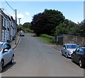
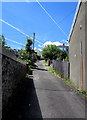
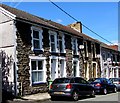
Photos of CF81 8WA

Area Information
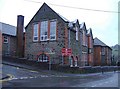
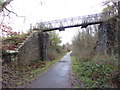
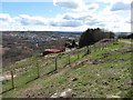
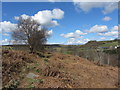
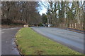
CF81 8WA lies in the heart of Bargoed, a historic town in the Rhymney Valley, Wales. This small postcode area, home to 1,419 residents, sits on the Rhymney River, straddling the ancient boundary between Glamorgan and Monmouthshire. The community is rooted in its industrial past, shaped by the colliery that once defined the area, though today it offers a quieter, residential lifestyle. With a median age of 47 and a population skewed toward adults aged 30–64, the area reflects a stable, mature demographic. Daily life here balances proximity to local amenities with the tranquillity of a small town. The postcode’s compact size means residents are close to essential services, including retail outlets and rail connections. Bargoed’s history as a market town and railway hub still influences its character, with landmarks like the town hall and war memorial adding to its distinct identity. For those seeking a blend of heritage and practicality, CF81 8WA offers a grounded, community-focused environment.
- Area Type
- Postcode
- Area Size
- Not available
- Population
- 1419
- Population Density
- 1559 people/km²
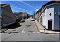
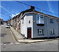
CF81 8WA is predominantly an owner-occupied area, with 68% of homes owned by their residents. The accommodation type is primarily houses, which is unusual for smaller postcode areas, suggesting a mix of larger properties and family homes. This housing stock indicates a market geared toward settled buyers rather than renters, though the small size of the area may limit options for those seeking a wider range of property types. The high home ownership rate and focus on houses imply a stable, low-turnover market. Buyers should consider the proximity to local amenities, such as retail stores and rail links, which enhance the area’s appeal. However, the limited size of the postcode means potential buyers may need to look beyond CF81 8WA for more diverse property choices.
House Prices in CF81 8WA
No properties found in this postcode.
Energy Efficiency in CF81 8WA
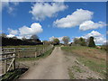
CF81 8WA offers a range of amenities within easy reach. Retail options include Iceland Bargoed, Morrisons Bargoed, and Spar, providing essential shopping for households. While dining and leisure facilities are not explicitly listed, the proximity to rail stations suggests access to broader leisure opportunities in nearby towns. The area’s historical industrial legacy is reflected in its landscape, with the former colliery site now a country park, offering recreational space. The compact nature of the postcode means residents can access daily necessities without long commutes. The blend of retail, transport, and green spaces contributes to a balanced lifestyle, though buyers should consider whether the amenities align with their specific needs.
Amenities
Schools
The nearest school to CF81 8WA is Bargoed Infants School, which falls under the ‘other’ category. No specific Ofsted rating is provided in the data, so its performance cannot be assessed here. Families with children may need to look further afield for secondary education options, as no other schools are listed for the area. The presence of a primary school suggests that basic educational needs are met locally, but the lack of detailed information on school quality or availability means prospective buyers should conduct further research into nearby institutions. The absence of additional schools highlights a potential limitation for families prioritising a comprehensive range of educational facilities.
| Rank | School | Type | Entry gender | Ages |
|---|
Explore more schools in this area
Go to Schools tabDemographics
The population of CF81 8WA is 1,419, with a median age of 47. The majority of residents fall within the 30–64 age range, indicating a community of working-age adults and older individuals. Home ownership is strong, with 68% of properties owner-occupied, suggesting a stable housing market. The predominant accommodation type is houses, reflecting a traditional, family-oriented layout. The predominant ethnic group is White, aligning with broader trends in the region. This demographic profile points to a mature, settled population with established roots. The absence of specific data on deprivation or diversity means the area’s social dynamics remain largely defined by its age and ownership statistics. For buyers, this suggests a low turnover of properties and a focus on long-term residency.
Household Size
Accommodation Type
Tenure
Ethnic Group
Religion
Household Composition
Age
Household Deprivation
NS-SEC
Explore more demographic insights in this area
Go to Demographics tabPlanning
Planning Constraints
- Flood RiskPremium
- Ramsar Wetland SitesPremium
- Area of Outstanding Natural BeautyPremium
- Protected Nature ReservePremium
- Protected WoodlandPremium
- Crime RiskPremium