Area Overview for Bedwas, Trethomas and Machen Community
Photos of Bedwas, Trethomas and Machen Community
Area Information
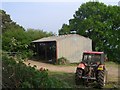
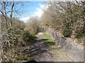
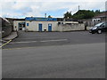
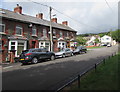
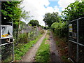
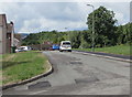
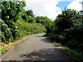
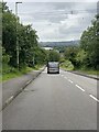
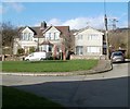
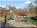
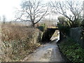
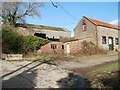
Living in Bedwas, Trethomas and Machen Community offers a distinct experience within the Caerphilly County Borough landscape. This civil parish covers an area of 18.4 km² and encompasses the villages of Bedwas, Trethomas and Machen. Historically part of the Bedwas and Machen Urban District until local government reorganisation in 1974, the area retains a deep connection to its coal mining roots. You will find that the community operates under a village council established after that reorganisation, maintaining local governance traditions. St Barrwg's parish church in Bedwas dates to at least the 12th century, first recorded in 1102, anchoring the village in historie significance. The landscape features notable structures like Bedwas Bridge, a fine early 19th-century structure, and a unique surviving Cornish pump house. These elements define the character of daily life here. The village of Machen is situated in the CF8 2WR postcode area, serving as a key identification point for residents and visitors alike. While the area was traditionally a farming community, its population dynamics have shifted significantly. The median age in the area stands at 70, indicating a settlement maturing with its past industries. You live in a space where the legacy of four coal pits and the Bedwas Navigation Colliery, which closed after the 1984-85 Miners' Strike, still shapes the atmosphere. Homes in Bedwas, Trethomas and Machen Community reflect this evolution from agricultural land to light industry zones like the Bedwas House Industrial Estate.
- Area Type
- Parish
- Area Size
- 18.4 km²
- Population
- 1526
- Population Density
- 1489 people/km²
Demographics
The community profile in Bedwas, Trethomas and Machen Community reveals an elderly population. You will find that the median age is exactly 70 years old. This demographic reality means the area suits retirees seeking a quieter life rather than families with young children. The total population stands at 1,526 people, resulting in a density of 1,489 people per square kilometre. Such figures indicate a relatively tight-knit neighbourhood where residents know their neighbours. Home ownership is the dominant housing tenure model in this parish. Data shows that 77 per cent of residents own their homes free and clear or with a mortgage. This high level of ownership suggests long-term stability and invested residents. The accommodation types present a mix suitable for older residents, though specific breakdowns by dwelling type are not detailed in current records. You do not find the transient nature of major rental hubs here. Instead, the household composition reflects stability, with many families having lived in the same properties for decades. The lack of renter statistics in the provided data reinforces the picture of a settled community. There is no indication of significant diversity issues, as the predominant ethnic group and religious breakdowns are recorded as total figures without further specification. For those considering buying homes in Bedwas, Trethomas and Machen Community, the environment feels established and rooted in long-term residency patterns.
Household Size
Accommodation Type
Tenure
Ethnic Group
Religion
Household Composition
Age
Household Deprivation
NS-SEC
Explore more demographic insights in this area
Go to Demographics tabPlanning
Planning Constraints
- Flood RiskPremium
- Ramsar Wetland SitesPremium
- Area of Outstanding Natural BeautyPremium
- Protected Nature ReservePremium
- Protected WoodlandPremium
- Crime RiskPremium