Area Overview for Bargoed Community
Photos of Bargoed Community

Area Information
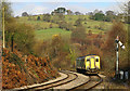
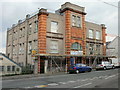
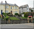
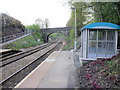
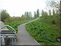
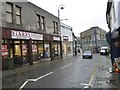
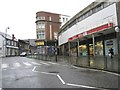
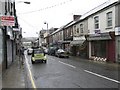
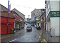
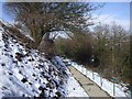
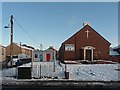
Bargoed Community sits within the Rhymney Valley in the county borough of Caerphilly, straddling the ancient boundary between Glamorgan and Monmouthshire. This civil parish covers 7.2 km² and holds a population of 3180 residents, creating a density of 444 people per km². You will find Bargoed along the Rhymney River, split into Bargoed and Aberbargoed. The history here is defined by the Rhymney railway and a colliery that opened in 1903 and closed in the 1970s. The site of that now-closed colliery has been transformed into a country park, offering open space near the historic Bargoed Town Hall. You can walk past the Bargoed and Gilfach war memorial, which was unveiled in 1923. Daily life revolves around this mix of industrial heritage and natural recovery. The town lies approximately 18½ miles north of Cardiff, connected to the capital by a railway viaduct. This history and geography define the character of homes in this parish. Living in Bargoed Community means accepting a terrain shaped by the coal industry but now softened by green spaces and river views. The community remains distinct from the broader 'Greater Bargoed' area, which includes Gilfach and Aberbargoed with a combined population of about 13,000. You are part of a specific parish with its own boundaries and history.
- Area Type
- Parish
- Area Size
- 7.2 km²
- Population
- 3180
- Population Density
- 444 people/km²
Demographics
The community profile of Bargoed Community shows an older population. The median age for residents is 70 years old. This age profile suggests a settlement with significant long-term residency rather than a hub for young families or recent graduates. A 60 per cent home ownership rate indicates that the majority of households have secured title to their properties. This statistic points toward stability and established residents who have stayed in the area for many years. The household composition data reflects a total population structure without specific breakdowns for singles or families in the provided figures. You will find that people living in Bargoed Community are predominantly settled. The accommodation type data shows a total count without specifying the ratio of detached, semi-detached, or terraced houses, though the history of colliery housing suggests a mix of estates. There is no data provided regarding the predominant ethnic group or religious affiliation within the parish boundaries. These demographic factors combine to create a specific social environment. The high age median and strong ownership rates outline a quiet, stable neighbourhood where residents are likely to know one another. This statistical picture contrasts with areas dominated by younger workers or high turnover. You are entering a place where the demographic weight lies with the older generation.
Household Size
Accommodation Type
Tenure
Ethnic Group
Religion
Household Composition
Age
Household Deprivation
NS-SEC
Explore more demographic insights in this area
Go to Demographics tabPlanning
Planning Constraints
- Flood RiskPremium
- Ramsar Wetland SitesPremium
- Area of Outstanding Natural BeautyPremium
- Protected Nature ReservePremium
- Protected WoodlandPremium
- Crime RiskPremium