Area Overview for Bargod
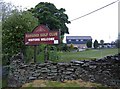
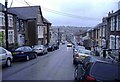
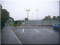
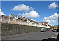
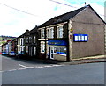
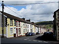
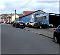
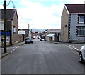
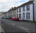
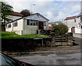
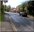
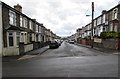
Photos of Bargod
Area Information
Bargod, a built-up area in Wales covering 1.6 km², offers a compact yet functional living environment. With a median age of 70, the community reflects a mature demographic, shaped by long-term residency and local traditions. The area’s proximity to key amenities, including five retail outlets like Morrisons Bargoed and Spar, ensures daily necessities are within reach. Rail connectivity is strong, with stations at Gilfach Fargoed, Bargoed, and Pengam providing links to broader networks. For families, Bargod’s schools—spanning nursery to junior levels—offer a range of educational stages. Digital connectivity is robust, with broadband scoring 94 (excellent) and mobile coverage at 83 (good), supporting both work and leisure. While the area lacks large-scale commercial hubs, its small-town character fosters a sense of familiarity. Bargod’s appeal lies in its practicality, with homes and services clustered closely, making it a viable choice for those prioritising convenience over urban sprawl.
- Area Type
- Built Up Area 250
- Area Size
- 1.6 km²
- Population
- Not available
- Population Density
- Not available
Bargod’s lifestyle is defined by its proximity to essential services and community-focused amenities. Retail options include major chains like Morrisons Bargoed and Iceland Bargoed, alongside smaller outlets such as Spar, ensuring daily shopping needs are met. The rail network, with stations at Gilfach Fargoed and Pengam, facilitates travel to nearby towns, though the area’s small size means many residents can manage without frequent trips. While parks or leisure facilities are not explicitly mentioned in the data, the presence of multiple schools and retail hubs suggests a community-oriented environment. The combination of practical amenities and limited sprawl creates a self-contained lifestyle, ideal for those prioritising convenience and familiarity.
Amenities
Schools
Bargod’s schools cater to multiple stages of education, including nursery, primary, and junior levels. Notable institutions include Gilfach Fargoed Nursery School, Bargoed Infants School, Gilfach Fargoed Primary School, The Graig Junior School, and St Gwlady’s Junior School. While the data does not provide Ofsted ratings, the variety of school types ensures families have options for early years education through to junior schooling. The presence of multiple schools within the area suggests a focus on local education, reducing the need for long commutes. However, the absence of secondary schools means students may need to travel further for higher education, which could be a consideration for families planning long-term residency.
| Rank | School | Type | Entry gender | Ages |
|---|
Explore more schools in this area
Go to Schools tabDemographics
Bargod’s population is predominantly older, with a median age of 70, reflecting a community where retirement and long-term residency dominate. Home ownership stands at 61%, suggesting a stable housing market with a mix of owner-occupied properties and rentals. The data does not specify household composition or accommodation types, but the overall profile indicates a settled, low-turnover demographic. The absence of detailed diversity metrics means broader cultural or ethnic composition remains unquantified. For residents, this age profile may influence local services and social dynamics, with community needs centred on healthcare and leisure rather than youth-focused amenities. The area’s character is defined by its older population, which shapes both the pace of life and the types of facilities available.
Household Size
Accommodation Type
Tenure
Ethnic Group
Religion
Household Composition
Age
Household Deprivation
NS-SEC
Explore more demographic insights in this area
Go to Demographics tabPlanning
Planning Constraints
- Crime RiskPremium