Area Overview for Ynysddu Community
Photos of Ynysddu Community


Area Information
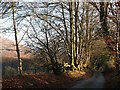
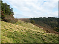
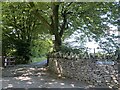
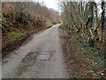
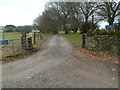
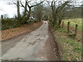
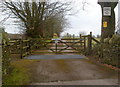
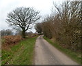
Living in Ynysddu Community offers a specific lifestyle within the Welsh parish system. This civil parish covers an area of 14.2 km², providing residents with a defined local territory. You will find a settlement that operates independently within the broader administrative framework of Wales. The space allows for a distinct rural character while maintaining ties to its official civil status. Prospective buyers should understand the scale of this community, as the land area directly influences the spread of properties and access to local green spaces. You are entering an environment where land use and planning follow parish-level governance. The size of the area suggests a dispersed living pattern rather than a dense urban conurbation. This geographical footprint supports a quiet existence away from the pressures of major cities. When you consider homes in Ynysddu Community, you are choosing a location with clear boundaries and a traditional parish identity. The physical extent of the land defines your daily commute routes and walking distances to services. It is a place where the 14.2 km² of land shapes the rhythm of everyday life. You should assess how this size fits your requirements for privacy versus proximity to amenities. The parish structure ensures local representation for all residents within these distinct borders.
- Area Type
- Parish
- Area Size
- 14.2 km²
- Population
- Not available
- Population Density
- Not available
Demographics
The community in Ynysddu Community reflects an older population profile compared to national averages. Data indicates a median age of 70 years, suggesting a significant number of retirees reside here. The most common age range recorded is Total, which encompasses the entire demographic spread from youngest to oldest. You should note that this high median age typically means fewer young families are present compared to younger areas. Home ownership stands at 70 per cent, establishing a stable, owner-occupied market rather than a rental-dependent one. This high rate implies long-term residents and potential stability in the streets. Accommodation types and household composition data are available in aggregate form but do not specify exact breakdowns for smaller categories. You should expect the housing stock to cater primarily to individuals or couples, given the age profile. Ethnic and religious data are recorded generally but do not specify dominant groups in the report. The absence of specific breakdowns for these demographics means the area appears broadly representative of the surrounding region. A deprivation analysis is not present in the current records, so you cannot quantify economic disadvantage directly. However, the high home ownership rate often correlates with financial stability for those who own their properties outright.
Household Size
Accommodation Type
Tenure
Ethnic Group
Religion
Household Composition
Age
Household Deprivation
NS-SEC
Explore more demographic insights in this area
Go to Demographics tabPlanning
Planning Constraints
- Flood RiskPremium
- Ramsar Wetland SitesPremium
- Area of Outstanding Natural BeautyPremium
- Protected Nature ReservePremium
- Protected WoodlandPremium
- Crime RiskPremium