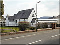
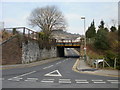
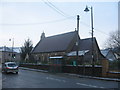
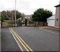
Area Overview for Risca East Community
Photos of Risca East Community
Area Information
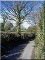
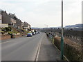
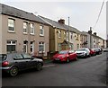
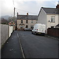
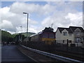
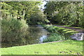
Living in Risca East Community offers a quiet existence within the smaller settlements near Risca in south-east Wales. This civil parish covers just 2.7 km², placing it among the larger villages in Rhondda Cynon Taf. The area provides a distinct setting for those seeking housing in Welsh countryside rather than a major urban centre. You will find yourself surrounded by a landscape that defines local daily life, far removed from the density found in Llanharan or the industrial history of the wider region. Residents here enjoy the benefits of a rural parish without being isolated from essential services nearby. The small footprint of the community contributes to a close-knit environment where neighbours often know one another. You can expect a pace of life that is measured and calm, suitable for families looking for space or individuals requiring a peaceful retreat. The location allows for easy access to other parts of the borough while maintaining a strong local identity. When you consider homes in Risca East Community, you are entering an area where the built environment is tightly integrated with the natural surroundings. The mix of housing reflects a steady evolution of the village over decades. Many properties within the parish boundaries have been adapted for modern living while retaining their historical character. This area remains a popular choice for those who prefer the stability of a established Welsh community over the rapid changes seen in larger towns.
- Area Type
- Parish
- Area Size
- 2.7 km²
- Population
- Not available
- Population Density
- Not available
Demographics
The most striking feature of living in Risca East Community is the advanced age profile of its residents. The median age stands at exactly 70 years, indicating a population dominated by retirees. You will encounter very few young families or children in the local streets. This demographic skew suggests the area has long been favoured by older adults seeking a quiet place to spend their later years. The community composition reflects a settled population with deep roots in the locality. Home ownership rates are notably high at 69%. This figure confirms that the vast majority of residents own their homes outright or with a mortgage. Consequently, the rental market within Risca East Community is relatively small. Most households consist of older couples or single adults managing their own property. This sense of permanence creates a stable environment where long-term tenants are rare. The accommodation types in the parish inevitably reflect these ownership patterns, with many older housing stock properties still standing. While specific data on ethnic diversity is not detailed in available records, the community reflects the broader rural settlement patterns of south-east Wales. You will find a population that has traditionally consisted of Welsh and Caucasian residents. The over-70 median age means service providers must cater to specific health and mobility needs. This demographic reality shapes every aspect of life in the parish, from local shop hours to community centre activities.
Household Size
Accommodation Type
Tenure
Ethnic Group
Religion
Household Composition
Age
Household Deprivation
NS-SEC
Explore more demographic insights in this area
Go to Demographics tabPlanning
Planning Constraints
- Flood RiskPremium
- Ramsar Wetland SitesPremium
- Area of Outstanding Natural BeautyPremium
- Protected Nature ReservePremium
- Protected WoodlandPremium
- Crime RiskPremium