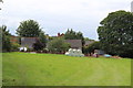
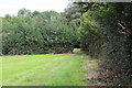
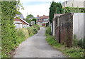
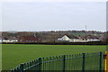
Area Overview for Penmaen Community
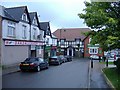
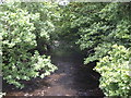
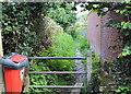
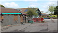
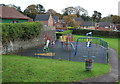
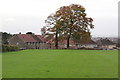
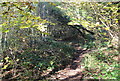
Photos of Penmaen Community

Area Information
Living in Penmaen Community offers a distinct experience within the civil parish of Wales. This area encompasses a total land size of 4.8 km², creating a defined local environment where daily life revolves around specific, manageable boundaries. You are stepping into a historic setting where the layout fosters close proximity to neighbours rather than sprawling suburban distances. The character of the area is shaped by its designation as a community parish, which often implies a strong, established local governance structure and a sense of shared responsibility among residents. The pace of life here moves at a different rhythm compared to major urban centres. Your surroundings are characterised by the natural terrain typical of this part of Wales, which dictates both the view and the utility of any homes in the area. There is a clear distinction in daily routine, where local amenities and community hubs play a central role in social interaction. As you consider Penmaen Community, you must weigh the benefits of this compact living arrangement against the specific constraints of the local infrastructure. The area does not offer the anonymity of a large city, but it provides a tangible connection to the land and the people who call this parish home.
- Area Type
- Parish
- Area Size
- 4.8 km²
- Population
- Not available
- Population Density
- Not available
Demographics
The population profile of Penmaen Community reveals an area with a median age of 70. This statistic indicates that the majority of residents are seniors, meaning the community atmosphere reflects an established, older demographic. You will find that neighbours in Penmaen Community are likely to have lived in homes in the area for many years, creating a settled society. While specific breakdowns for household composition, accommodation types, predominant ethnic groups, and religious affiliations are not detailed in the current records, the age profile alone suggests a quiet, stable environment focused on retirement or later life. Home ownership stands at 81%, which is a critical fact for anyone considering a move. This figure demonstrates that the vast majority of properties are owned outright or with a mortgage rather than rented. Such a high rate of ownership suggests strong financial stability among residents and a lack of frequent turnover, which can mean quieter streets. When evaluating vivant in this community, you should understand that the social fabric is woven by long-term owners who root themselves deeply into the parish. The demographic data paints a picture of adw respectfully aged population where intergenerational mixing may be less prominent than in younger urban areas.
Household Size
Accommodation Type
Tenure
Ethnic Group
Religion
Household Composition
Age
Household Deprivation
NS-SEC
Explore more demographic insights in this area
Go to Demographics tabPlanning
Planning Constraints
- Flood RiskPremium
- Ramsar Wetland SitesPremium
- Area of Outstanding Natural BeautyPremium
- Protected Nature ReservePremium
- Protected WoodlandPremium
- Crime RiskPremium