Area Overview for New Tredegar Community
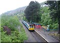
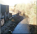
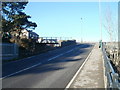
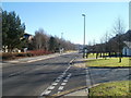
Photos of New Tredegar Community
Area Information
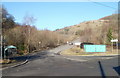
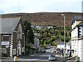
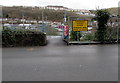
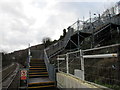
New Tredegar Community stands as a distinct civil parish covering an area of 9.7 square kilometres in Wales. The population totals 1,593 residents, resulting in a population density of 165 people per square kilometre. This density places the parish within a manageable land footprint, balancing residential space with surrounding geography. Living in New Tredegar Community involves settling into a locality where the built environment is spread across this specific land area. The settlement functions as an independent administrative unit within the wider region, offering a defined sense of place for homeowners and residents alike. Daily life here is shaped by the parish boundaries and the local infrastructure that serves these 1,593 inhabitants. Prospective homebuyers should consider the geographical spread when evaluating commute times or access to specific amenities within the 9.7 square kilometre limit. The area represents a specific pocket of life in Wales where community borders are clearly established. Each property purchase adds to the local fabric of this recognised civil parish. The size of the landmass directly influences how people navigate their daily routines and interact with their immediate surroundings. Understanding the physical scale of New Tredegar Community helps residents appreciate the spatial relationships within their home and neighbourhood. This factual context grounds all future decisions regarding property investment or relocation to the area.
- Area Type
- Parish
- Area Size
- 9.7 km²
- Population
- 1593
- Population Density
- 165 people/km²
Demographics
The demographic profile of New Tredegar Community reflects an older population with a median age of 70 years. This age distribution indicates a community dominated by older residents and retirees rather than young families or working-age professionals. Home ownership stands at 59 per cent, meaning just over one in two households owns their property outright or with a mortgage. This ownership level exceeds the national average for owner-occupied housing in similar rural Welsh contexts. The remaining households comprise renters or shared ownership arrangements, though the exact split by household composition remains unbroken in the public record. Accommodation types span various styles typical of the region, but specific breakdowns by property age or style are not itemised here. Ethnic diversity information is not available for this specific parish, suggesting a largely homogenous community profile. Religious affiliation figures for the area are also not recorded in the current dataset. The high median age suggests local services may prioritise healthcare and leisure facilities suitable for seniors. Quality of life here is defined by this stable, older demographic rather than a transient or young workforce. Purchasing homes in New Tredegar Community often aligns with retirement planning or long-term settlement rather than short-term investment. The community character is firmly established by these age and ownership statistics.
Household Size
Accommodation Type
Tenure
Ethnic Group
Religion
Household Composition
Age
Household Deprivation
NS-SEC
Explore more demographic insights in this area
Go to Demographics tabPlanning
Planning Constraints
- Flood RiskPremium
- Ramsar Wetland SitesPremium
- Area of Outstanding Natural BeautyPremium
- Protected Nature ReservePremium
- Protected WoodlandPremium
- Crime RiskPremium