Area Overview for Maesycwmmer Community
Photos of Maesycwmmer Community

Area Information
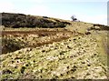
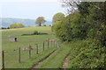
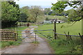
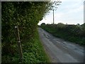
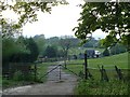
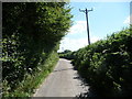
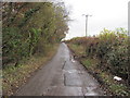
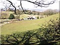
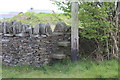
Maesycwmmer Community is a civil parish situated in the Rhymney Valley within Caerphilly County Borough, Wales. The area spans 7.5 km² and sits on the east bank of the Rhymney River, approximately eight kilometres north of Caerphilly town. You will find the village defined by significant industrial heritage, as it emerged during the Industrial Revolution in the South Wales Coalfield. The community operates from the historic boundaries of Monmouthshire and lies opposite Hengoed. A vast landmark overshadows the residential streets: the Maesycwmmer Viaduct. This structure dates back to 1853 as part of the Newport, Abergavenny and Hereford Railway. Although originally built for workers constructing the railway extension, the viaduct was reopened for public pedestrian access in 2000. The built environment reflects this background, with the parish designated as a Conservation Area due to its distinct built heritage. The most common residence in the area is a house, fitting the profile of a traditional British village. Reverend John Jenkins built the first large house on the site in 1826, after which the name Maesycwmmer came into use around 1840. You can explore the landscape to discover a disused quarry located behind houses in St Annes Gardens. Living in Maesycwmmer Community means residing in an area shaped by transport history and agricultural origins, now functioning as a peaceful settlement within a larger county borough.
- Area Type
- Parish
- Area Size
- 7.5 km²
- Population
- Not available
- Population Density
- Not available
Demographics
The population profile of Maesycwmmer Community is clearly defined by its age structure, with a median age of 70 years. This statistic indicates an older community where you are more likely to encounter residents seeking retirement accommodation or long-term stability rather than young families moving for career reasons. The age distribution data confirms that the total population cluster skews heavily toward older demographics, reflecting the area's character as an established settlement with deep roots in the local history. Home ownership represents a stable feature of this community, with 77% of households owning their properties. This high percentage suggests that many residents have lived in their homes for decades, contributing to a quiet, settled atmosphere. The area does not contain significant data regarding specific ethnic groups or religious affiliations in the provided records, but the high ownership rate implies a community where residents have built permanent ties to the locality. Household composition data focuses on the total population count of approximately 2,418 people. When you consider living in Maesycwmmer Community, expect an environment where established families and individuals value stability. The community council, formed in 1985, oversees these demographics, managing a parish that functions as a distinct ward within the broader Caerphilly framework.
Household Size
Accommodation Type
Tenure
Ethnic Group
Religion
Household Composition
Age
Household Deprivation
NS-SEC
Explore more demographic insights in this area
Go to Demographics tabPlanning
Planning Constraints
- Flood RiskPremium
- Ramsar Wetland SitesPremium
- Area of Outstanding Natural BeautyPremium
- Protected Nature ReservePremium
- Protected WoodlandPremium
- Crime RiskPremium