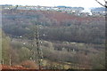
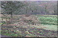
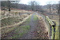
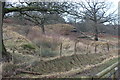
Area Overview for Crumlin Community
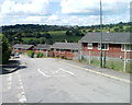
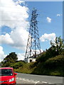
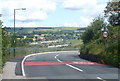
Photos of Crumlin Community

Area Information
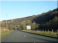
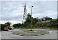
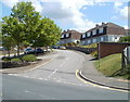
Crumlin Community stands as a distinct civil parish in Wales, covering an area of 13.0 km². It is a substantial piece of land that defines the local boundaries for residents searching for homes in this region. The parish represents a settled environment where daily life revolves around established local patterns. Living in Crumlin Community offers a defined geographical space that separates it from surrounding towns. The total area provides enough room for a mix of open spaces and built-up zones, creating a clear identity for the locality. Prospective buyers often look for areas with a clear civil parish status, and Crumlin Community fits this description perfectly. The 13.0 km² size suggests a village-sized population rather than a dense urban centre, which influences the pace of life here. You will find a place where the boundaries are well understood and the community extends over a recognised area. This clarity makes it straightforward to understand the land you are purchasing when considering Crumlin Community as your new home.
- Area Type
- Parish
- Area Size
- 13.0 km²
- Population
- Not available
- Population Density
- Not available
Demographics
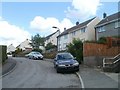
The demographic profile of Crumlin Community is dominated by an older population. The median age for residents is 70, indicating that the majority of people living here have retired or are retired. This age concentration shapes the social fabric and the needs of the local services. You are looking at an area where Age groups shift significantly towards the older end of the spectrum. Home ownership stands at 70 percent, a figure that suggests property is largely tied to long-term residents rather than transient tenants. Most households consist of older demographics, reinforcing the picture of a settled, established community. The accommodation types reflect this reality, with properties suited to those who have remained in the area for decades. Diversity and specific household composition details are not available in the current records, so you rely on the strong signal of a pensioner-heavy population. Living in Crumlin Community means joining a group where residents share a similar life stage. The high home ownership rate means less turnover, which can mean quieter streets but also fewer immediate neighbours for socialising.
Household Size
Accommodation Type
Tenure
Ethnic Group
Religion
Household Composition
Age
Household Deprivation
NS-SEC
Explore more demographic insights in this area
Go to Demographics tabPlanning
Planning Constraints
- Flood RiskPremium
- Ramsar Wetland SitesPremium
- Area of Outstanding Natural BeautyPremium
- Protected Nature ReservePremium
- Protected WoodlandPremium
- Crime RiskPremium