Area Overview for Crosskeys Community
Photos of Crosskeys Community
Area Information
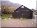
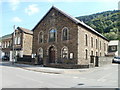
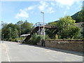
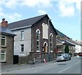
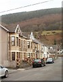
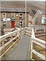
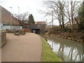
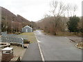
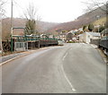
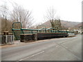
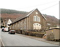
Crosskeys Community is a civil parish located in Caerphilly county borough, Wales. You will find it situated at the confluence of the Ebbw and Sirhowy rivers within the South Wales Valleys. The area covers a total size of 5.7 km², offering a compact village setting for residents. Locally known as Pont-y-cymer in Welsh, which translates to bridge at the confluence of rivers, the location sits near coordinates 51.624075, -3.123422. Your daily life here transitions from a heavy industrial past to a quieter modern existence. Originally developed from the 1830s to serve local coal mines, the community includes historical sites like the Black Vein and New Risca pits. Now, you can enjoy a quiet environment complete with a residents' society. A large park in the lower part of the village provides open space for recreation. Nearby Pontywaun, typically considered part of Crosskeys, features listed buildings that add character to the neighbourhood. The local Crosskeys Silver Band continues its work as a charity, contributing to local life. You have access to a railway station on the Ebbw Vale Line, ensuring connectivity to wider networks. Living in this community means appreciating a distinct village heritage while engaging with practical modern amenities.
- Area Type
- Parish
- Area Size
- 5.7 km²
- Population
- Not available
- Population Density
- Not available
Demographics
The demographic profile of Crosskeys Community reveals a population with a strong tendency towards older living. The median age stands at 70 years old. This figure represents the most common age range within the total population. You are looking at an area where many households consist of older residents. House ownership levels are notably high, with 67% of the total accommodation occupied by owners. This statistic indicates a predominance of private homeownership over rental arrangements. The data shows no specific breakdown for predominant ethnic groups, religion, or specific household composition categories beyond the total population. Consequently, there is no available information to describe diversity or specific family types within the area. The absence of these specific data points means you cannot make claims about multicultural density or single-parent households here. You must rely on the clear fact that nearly two-thirds of properties are owner-occupied. This creates a community where long-term residence is common. The high age median suggests a slower pace of life compared to younger urban centres. Your understanding of who lives here is defined by these concrete ownership and age statistics.
Household Size
Accommodation Type
Tenure
Ethnic Group
Religion
Household Composition
Age
Household Deprivation
NS-SEC
Explore more demographic insights in this area
Go to Demographics tabPlanning
Planning Constraints
- Flood RiskPremium
- Ramsar Wetland SitesPremium
- Area of Outstanding Natural BeautyPremium
- Protected Nature ReservePremium
- Protected WoodlandPremium
- Crime RiskPremium